back banner
back button
spacer
ocean explorer home pageNOAA home page

Location map showing East Diamante and the Sarigan submarine volcanoes


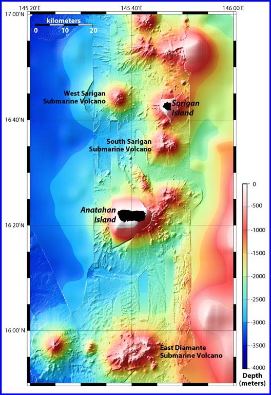
Location map showing East Diamante and Sarigan submarine volcanoes, as well as the volcanic islands of Sarigan and Anatahan. The bathymetry data are a combination of satellite bathymetry overlaid with EM300 multibeam bathymetry, which was collected on the present cruise. Note the differences.


Related Links

Submarine Ring of Fire 2003 Exploration

Submarine Ring of Fire 2003 Exploration: February 17 Log

Download high resolution image (776 kb, jpeg)


E-mail Updates | User Survey | Report Error On This Page | Site Index | Contact Us
Revised July 11, 2005 by the Ocean Explorer Webmaster
National Oceanic and Atmospheric Administration | U.S. Department of Commerce
NOAA Logo Commerce Logo
http://oceanexplorer.noaa.gov/explorations/03fire/logs/feb17/media/islands.html