back banner
back button
spacer
ocean explorer home pageNOAA home page

Map and photo of Maug caldera


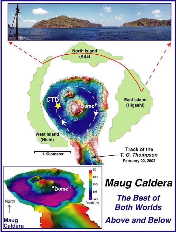
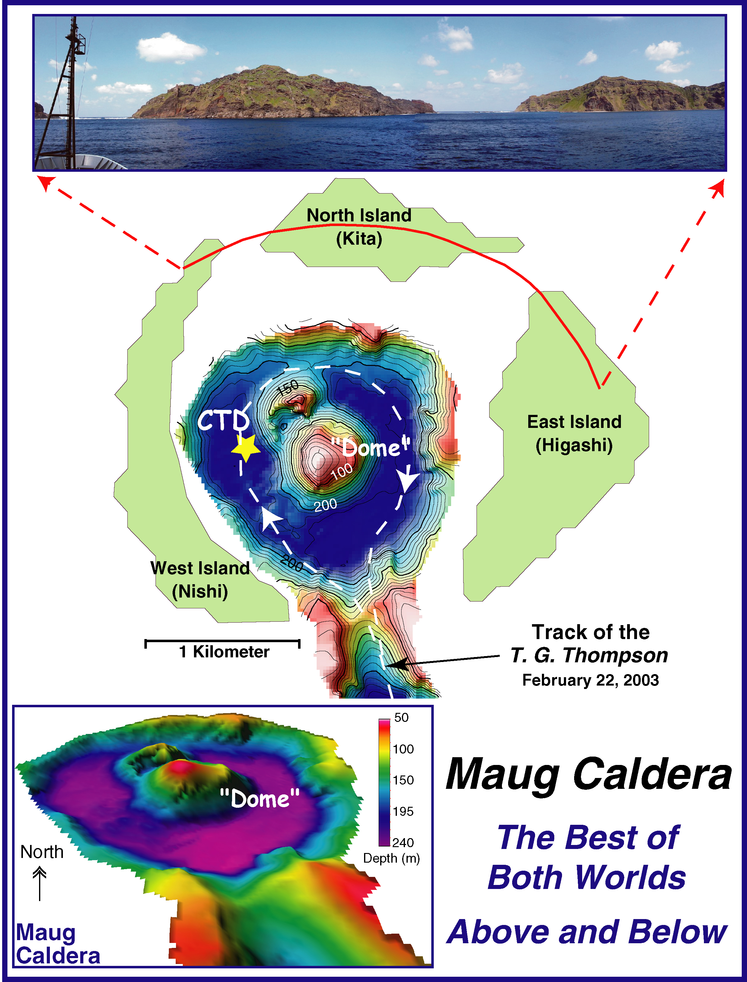
The bathymetry map in the center of the image shows the location of the CTD cast in the Maug caldera. The white dashed line indicates the trackline of the Thompson. In the lower left corner is a three-dimensional image of the submerged caldera. The data were gridded at 15 meters with no vertical exaggeration. The top of the figure shows a panorama of the islands of Maug. From left to right one can see the northern corner of Nishi, all of Kita, and the majority of Higashi.


Related Links

Submarine Ring of Fire 2003 Exploration

Submarine Ring of Fire 2003 Exploration: February 24 Log

Download high resolution image (3.2 Mb, jpeg)


E-mail Updates | User Survey | Report Error On This Page | Site Index | Contact Us
Revised July 11, 2005 by the Ocean Explorer Webmaster
National Oceanic and Atmospheric Administration | U.S. Department of Commerce
NOAA Logo Commerce Logo
http://oceanexplorer.noaa.gov/explorations/03fire/logs/feb24/media/maugmap.html