back banner
back button
spacer
ocean explorer home pageNOAA home page

Digital terrain model


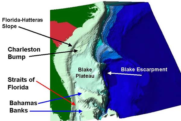
The Charleston Bump lies at the north end of the Blake Plateau. This image was created using data from the National Geophysical Data Center (NGDS). Credit: Phil Weinbach, SCDNR Marine Resources Division GIS lab.

Related Links

Islands in the Stream: September 28 Log

Maps Gallery


E-mail Updates | User Survey | Report Error On This Page | Site Index | Contact Us
Revised July 12, 2005 by the Ocean Explorer Webmaster
National Oceanic and Atmospheric Administration | U.S. Department of Commerce
NOAA Logo Commerce Logo
http://oceanexplorer.noaa.gov/explorations/islands01/log/sep28/media/sab_habitats.html