Meet Wanda Vargas
Trainee Wanda Vargas served as a mapping watchstander on board the NOAA Ship Okeanos Explorer. Read the full text of Wanda's interview below to learn more about her experience.
About Wanda's Role
What were your duties as an Explorer-in-Training?
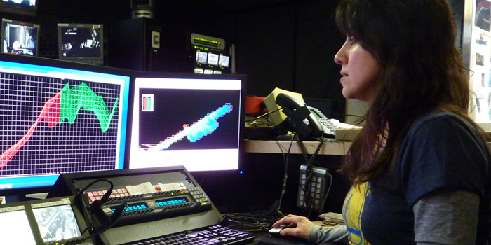
As a mapping watchstander there are two main responsibilities: to keep an eye on the data acquisition software and trouble shoot any problems and to process and clean the data as raw data files are accumulated.

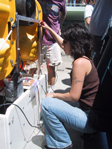
Wanda prepares the OBS (ocean bottom seismometer) for deployment over the East Pacific Rise.
Which school are you attending?
I will begin the Masters in Teaching program at the American Museum of Natural History this June.
Where was your work experience located? If you were working at sea, what were your impressions of living and working on a ship?
I was located onboard the NOAA Ship Okeanos Explorer. For me it is an amazing experience to serve on a working vessel. I felt safe knowing that the crew was focused 110 percent on ship safety and I felt privileged to be a part of the mapping team.

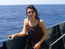
Wanda found that she really enjoyed being at sea.
What sparked your initial interest in ocean sciences?
My first oceanographic cruise was truly a life-changing experience for me. It was very exciting to be able to see the data you are acquiring (sonar and bathymetric images) of the location you are standing above and knowing you played a part in this collection. It was actually FUN!
What was the most personally rewarding part of your experience?
Professionally, the rewarding part was to be involved in the bathymetric image acquired. I can look at the map and say “I was on watch during the acquisition of the data for this area.”
Personally, to have a 360 degree ocean view topped with beautiful sunsets or sunrises.
What is the most unexpected thing you have learned?
Every oceanographic cruise that I am fortunate to have participated in confirms my love and dedication for the field. But for this particular cruise, I was surprised to find out my sea legs were hardier than I thought since I handled the choppy seas fairly well.
Please describe your final project.
The mapping project was to obtain bathymetric imagery of the United States’ Northeastern continental shelf, slope, and rise.
How do you see this experience fitting in with your future career plans?
It is my hope to continue to grow and develop in this field and further contribute to oceanographic exploration.