
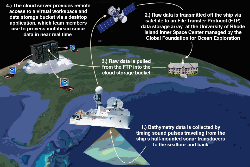
Seafloor mapping provides explorers, scientists, and more with a picture of the seafloor. During expeditions, bathymetry data is collected by SONAR systems onboard the ship. The data is then sent to shore, where more explorers are ready to clean, analyze, and share the data!