
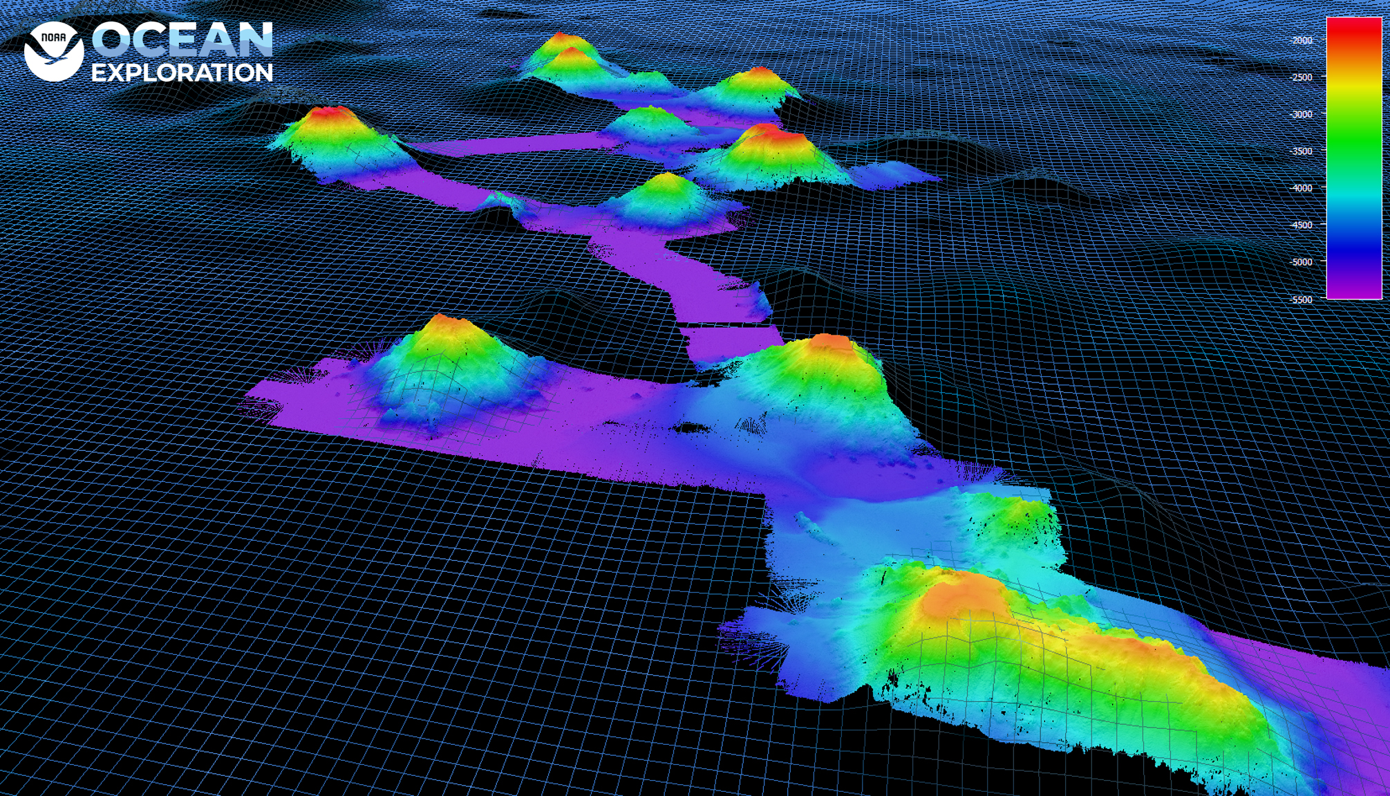
Almost 40 seamounts were mapped during the 2021 North Atlantic Stepping Stones: New England and Corner Rise Seamounts expedition, including more than half that had little to no preexisting data. This data not only helps the mission team decide where to conduct ROV dives to further explore the seamounts, but also improves our understanding of the North Atlantic seamount chains.