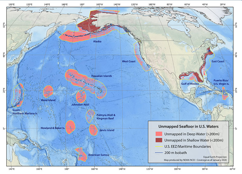
The U.S. Exclusive Economic Zone (EEZ) extends from the edge of the U.S. territorial waters (12 nautical miles off of the U.S. coast) out to 200 nautical miles offshore. Mapping the complete EEZ is an important goal for ocean expeditions in U.S. waters. This map shows the boundaries of the U.S. EEZ, outlined in yellow, as well as deep and shallow water areas of the U.S. EEZ that have not been mapped as of January 2020.
Mapping the EEZ
Map created by NOAA’s National Centers for Environmental Information. Download image (jpg, 146 KB).

The U.S. Exclusive Economic Zone (EEZ) extends from the edge of the U.S. territorial waters (12 nautical miles off of the U.S. coast) out to 200 nautical miles offshore. Mapping the complete EEZ is an important goal for ocean expeditions in U.S. waters. This map shows the boundaries of the U.S. EEZ, outlined in yellow, as well as deep and shallow water areas of the U.S. EEZ that have not been mapped as of January 2020.