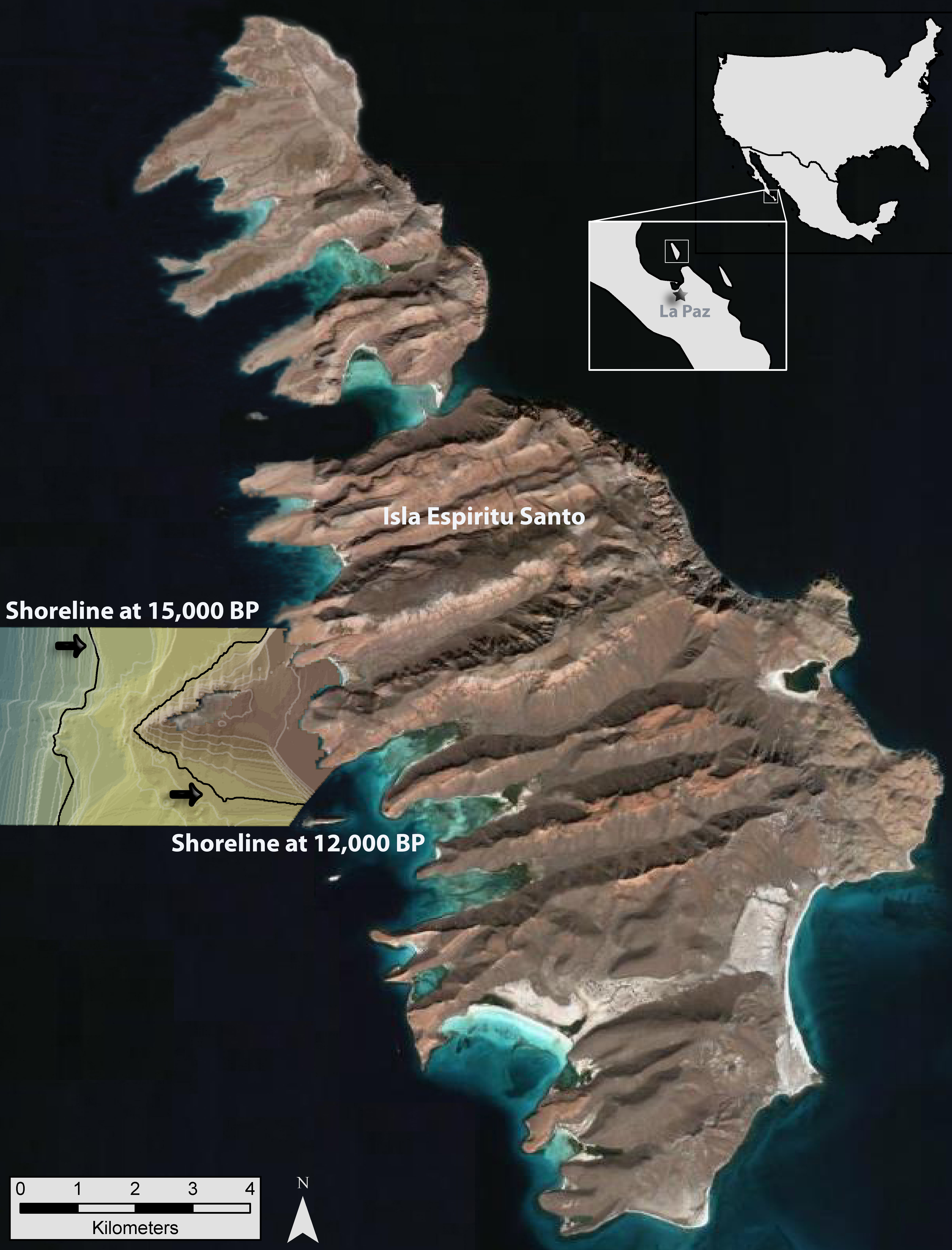
Aerial view of Isla Espíritu Santo merged with a digital elevation model of a section of the submerged landscape that shows locations of shorelines at 15,000 and 12,000 years ago.
