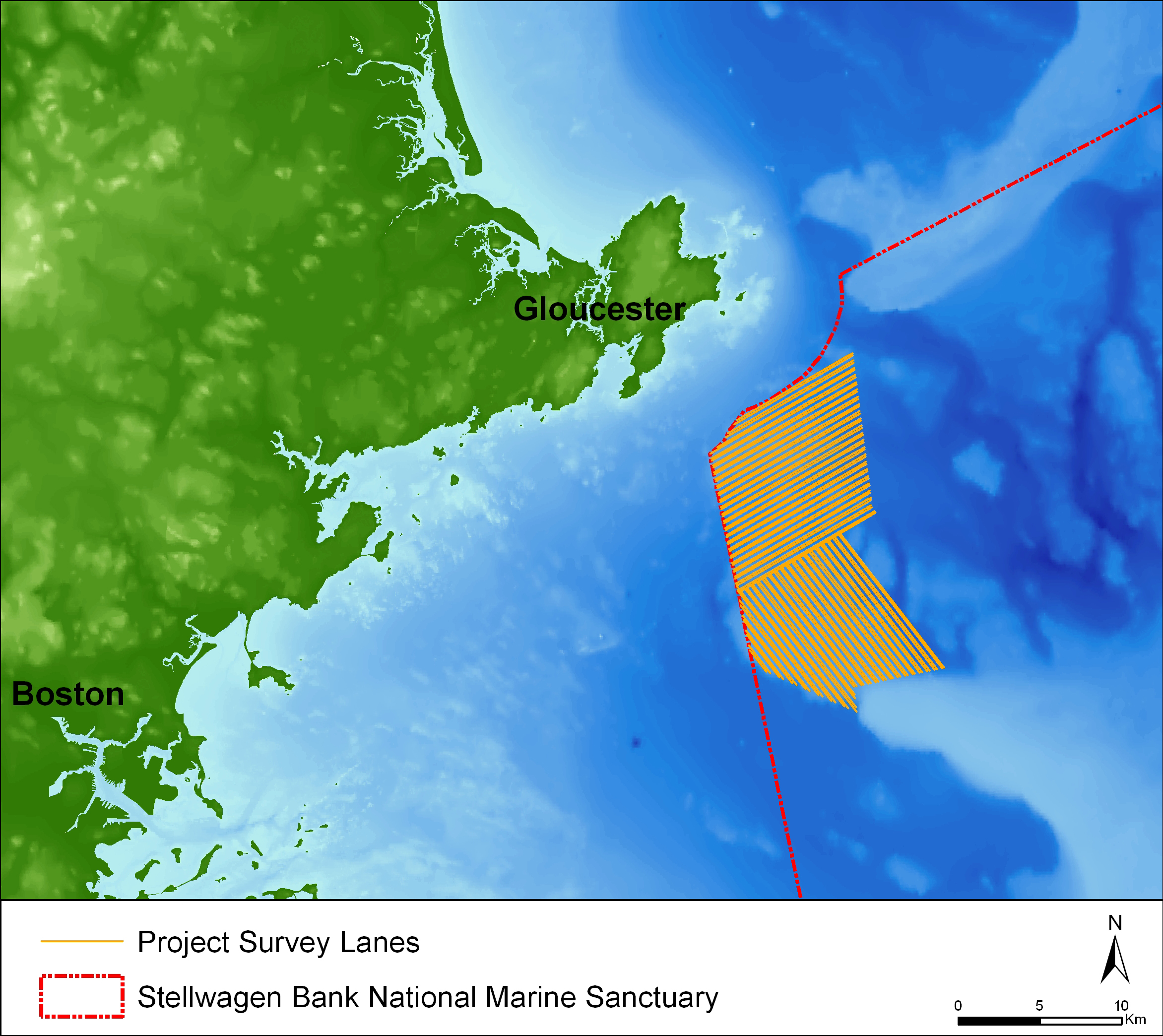
This map depicts the survey lanes completed during the project. In total, the project mapped 169 square kilometers of seafloor, equal to 7.7 % of the sanctuary’s total area.
