
By Keeley Belva - NOAA's Office of Ocean Exploration and Research
August 23, 2010
Today I was able to go on a quick side trip to go check out a nearby lighthouse. The Great Lakes are dotted with lighthouses, and the Thunder Bay area is no exception.

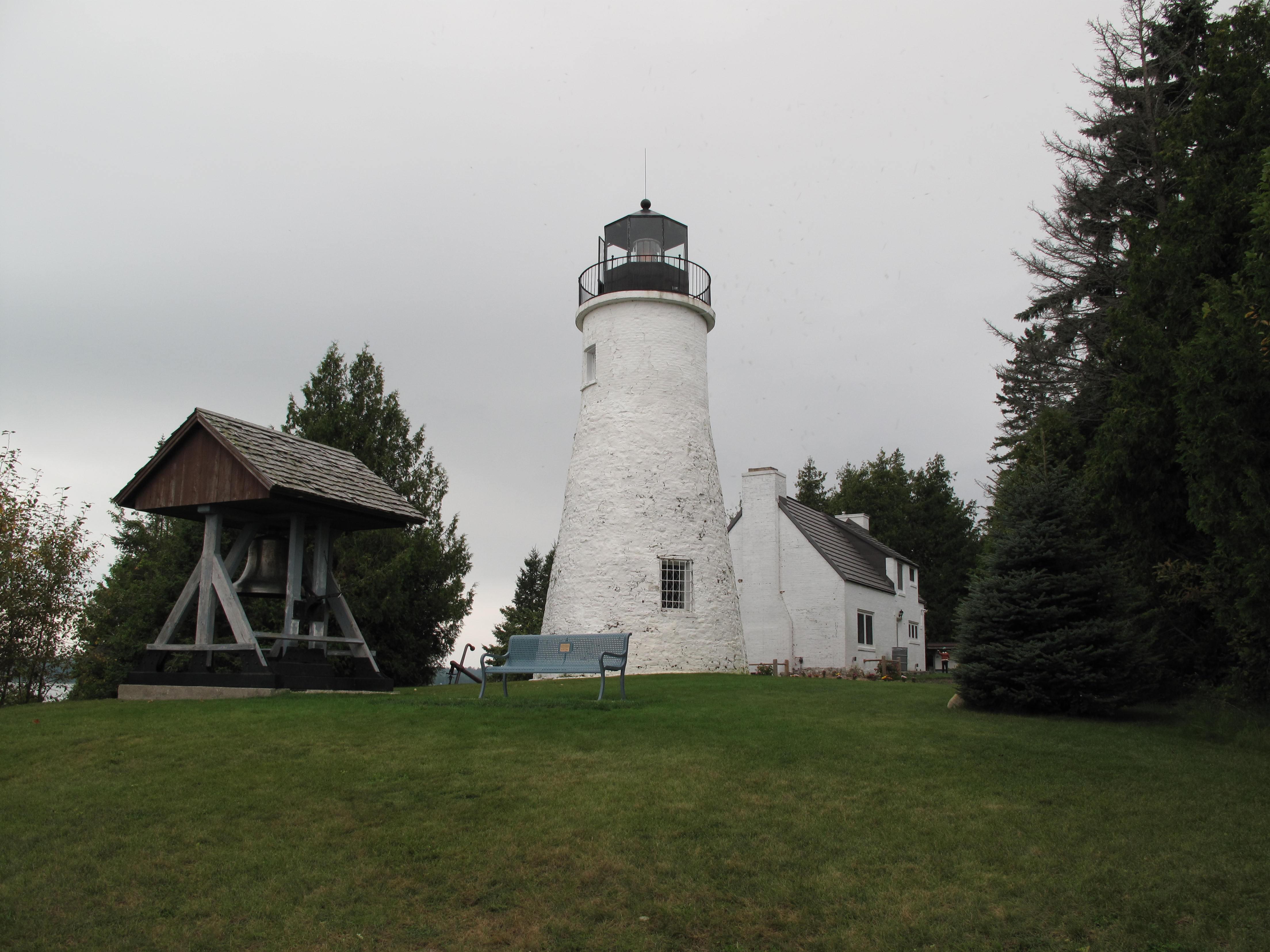
The 40 Mile Point Lighthouse was named because of its location — 40 miles southeast of Mackinac Island and 40 northwest of Thunder Bay. It remains a working light station to this day. Image courtesy of Thunder Bay 2010 Expedition, NOAA-OER. Download larger version (jpg, 551 KB).
The reason for all of the lighthouses is the same reason that we are here looking for shipwrecks—the waters here could be rough and unpredictable. There were many ships that were transiting the lakes and coming in and out of ports close to rocky, uncharted shorelines. We had a little taste of this yesterday while we were out: we got a close view of several ships, more than we had seen total in the last few days.

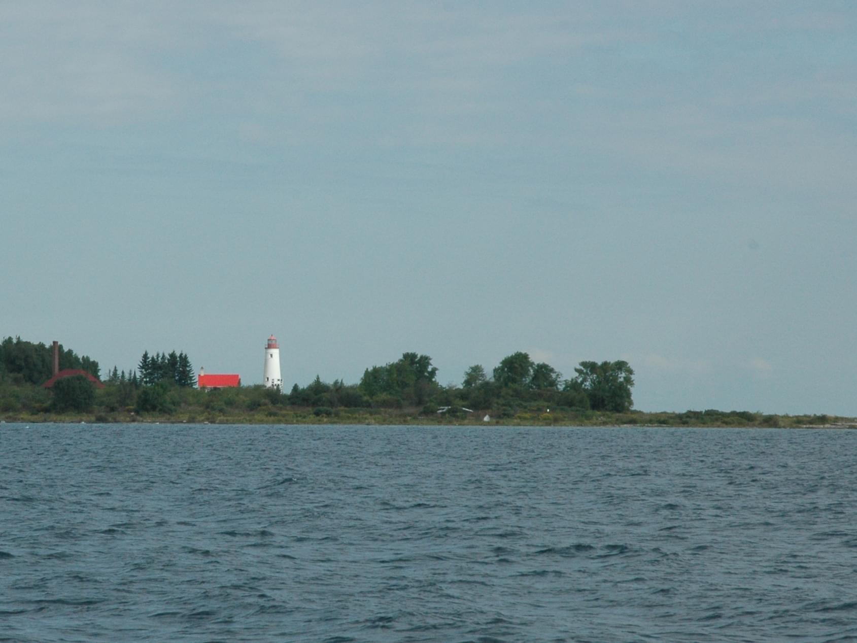
While surveying near Thunder Bay Island, we were able to catch a glimpse of the lighthouse. The Thunder Bay Island Lighthouse was the third lighthouse built on Lake Huron. Image courtesy of Thunder Bay 2010 Expedition, NOAA-OER. Download larger version (jpg, 173 KB).

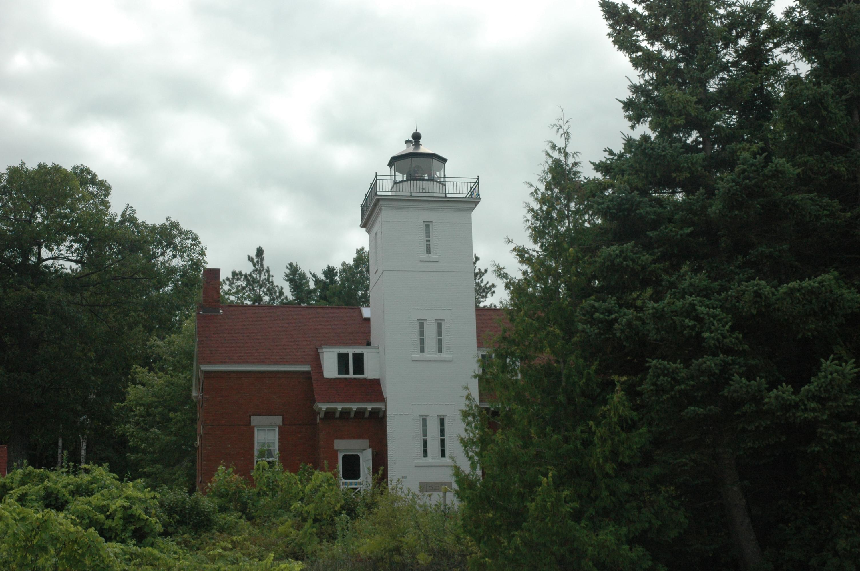
The Old Presque Isle Lighthouse was completed in 1840. It was replaced by the New Presque Isle Lighthouse 31 years later, after it was determined that the old light house needed too many repairs. The New Presque Isle Lighthouse was built taller and in a better location on the peninsula. Image courtesy of Thunder Bay 2010 Expedition, NOAA-OER. Download larger version (jpg, 1.2 MB).
During the 1820s, lighthouses began marking the shorelines of the Great Lakes, warning ships of hazards and foggy conditions, and marking harbors. The goal was for ships to always have a light in sight. Each of the lighthouses had to have a different lighting pattern so that it could be identified from sea. Lightkeepers were needed to maintain the lights and generally lived in quarters that were attached to or nearby the lighthouse itself. At 40 Mile Point Lighthouse, you can tour the lightkeepers quarters, which have been restored to the 1920s era. At that location, there were also assistant lightkeepers quarters and a bunk house, since it was so far removed from towns.

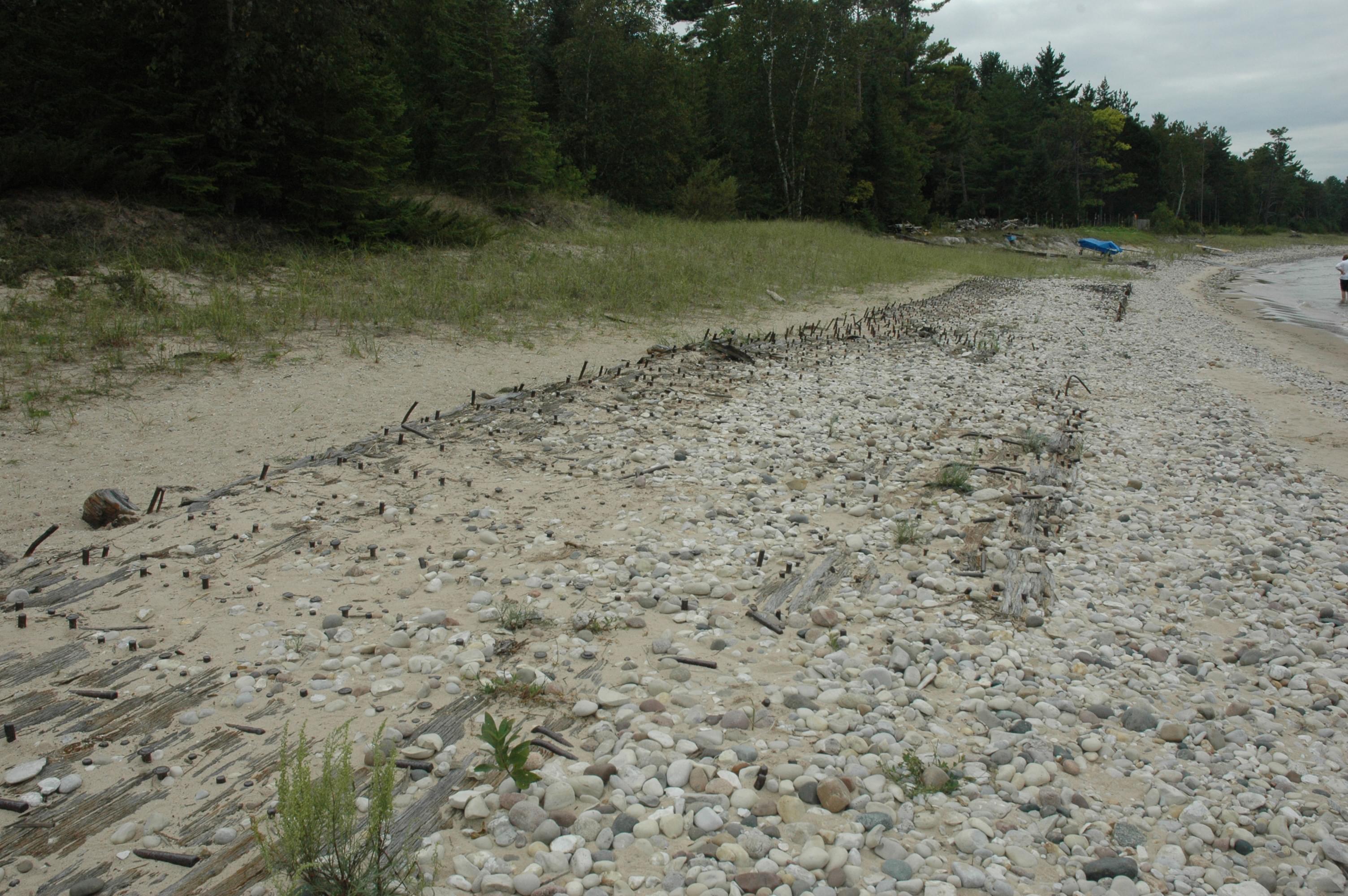
Here you can see remains of a shipwreck — the J. S. Fay — that washed up on the beach in front of the 40 Mile Point Lighthouse in 1905. Image courtesy of Thunder Bay 2010 Expedition, NOAA-OER. Download larger version (jpg, 814 KB).

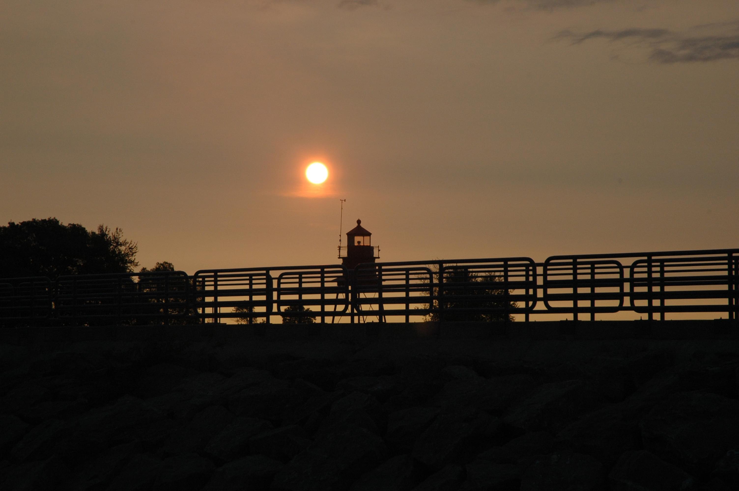
The Alpena Breakwater Light at sunrise as the ATLAS team leaves the harbor to begin surveys. Image courtesy of Thunder Bay 2010 Expedition, NOAA-OER. Download larger version (jpg, 260 KB).
The United States Coast Guard assumed control of lighthouses in 1939 and continues to maintain active light stations. Many lighthouses today are run by non-profit organizations and used as museums.
Want to learn more? View interesting, comprehensive information on Michigan's lighthouses .


