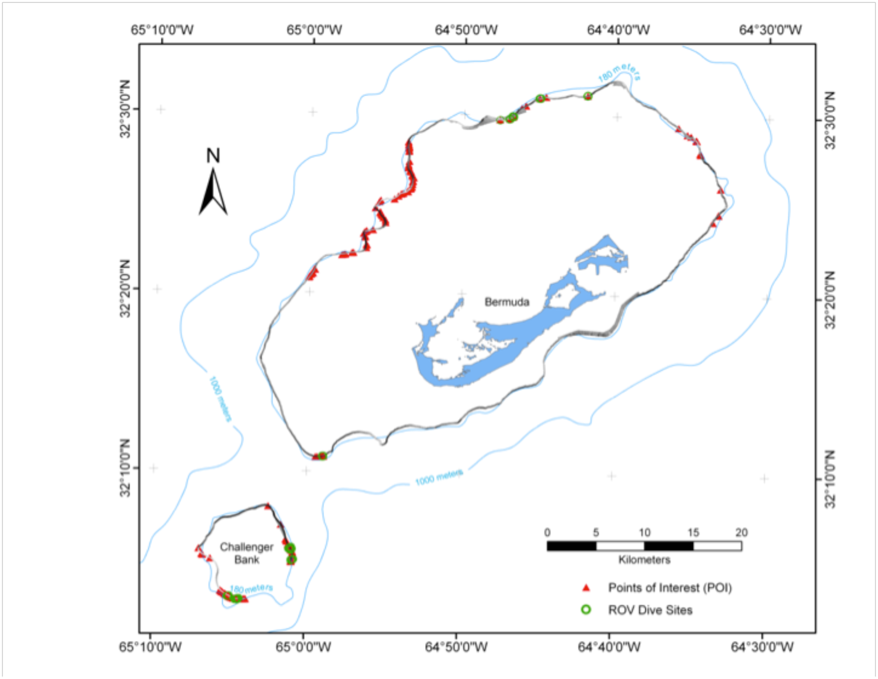
 varies considerably in some locations from our more precisely mapped position (darker line).")
Multibeam map of the shelf edge of the Bermuda Platform and Challenger Bank overlaid on top of the nautical chart of the island. Points of Interest, indicating potential cave entrances, are marked by red triangles, while ROV dive sites are indicated by green circles. Contour lines are from current nautical charts. Note that the 180 m contour derived from nautical charts (light blue line) varies considerably in some locations from our more precisely mapped position (darker line).