, and in profile (bottom) using IVS Fledermaus software. Position and extent of the profile across the escarpment face is indicated by the polyline in the upper image. All dimensions are in meters.")
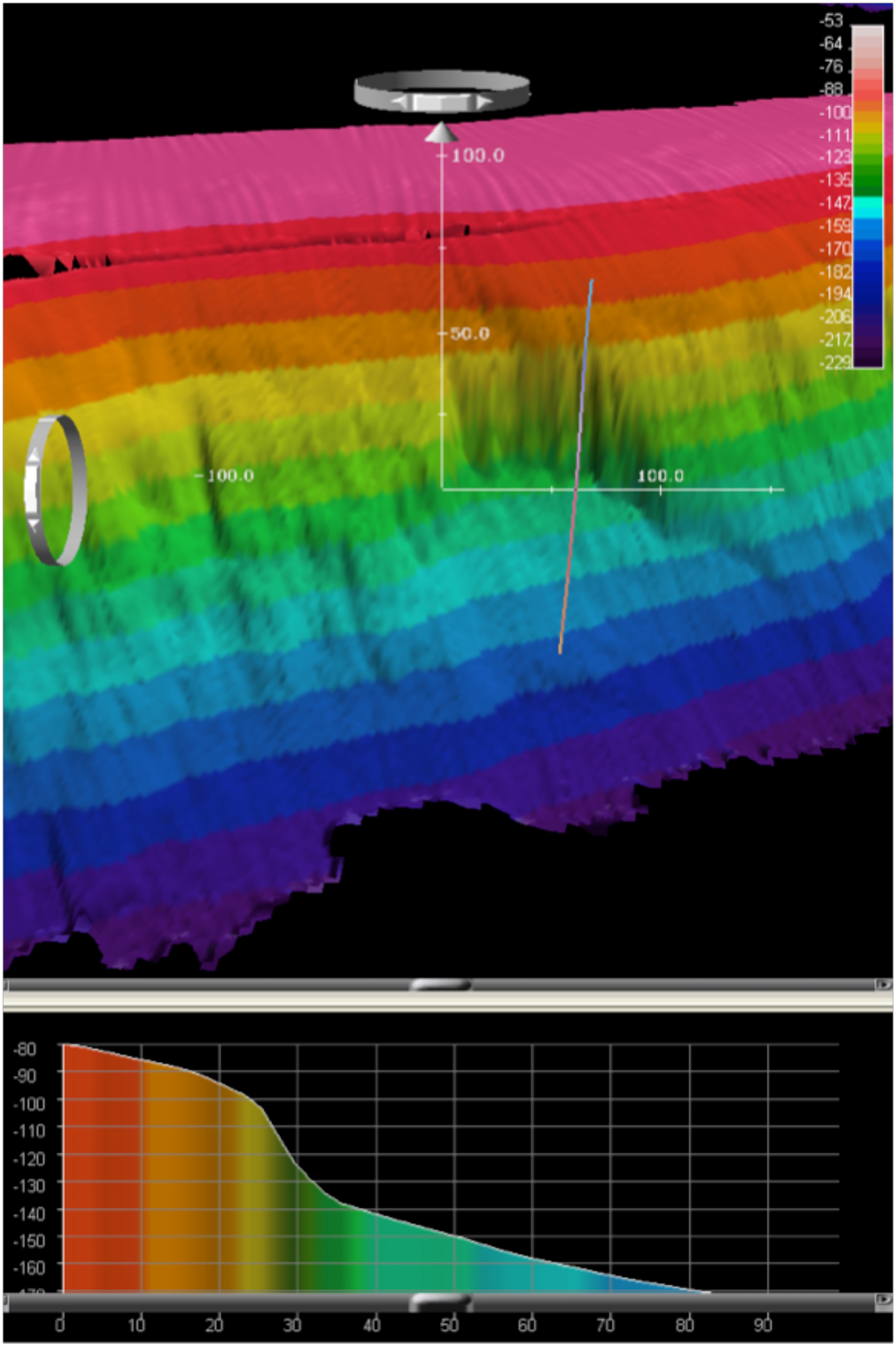
Multibeam bathymetry data gridded at 2m cell size of a submarine landslide escarpment discovered on the eastern edge of the Challenger Bank platform rendered in 3D shaded relief, colored by depth in (top), and in profile (bottom) using IVS Fledermaus software. Position and extent of the profile across the escarpment face is indicated by the polyline in the upper image. All dimensions are in meters.