
By Ken Rubin, Professor of Volcanology and Geochemistry - University of Hawaii
September 23, 2012
1231 GMT
Wind – WNW @ 5 kts
Air Temperature – 23.9° C (75.1° F)
Sea State – 1m
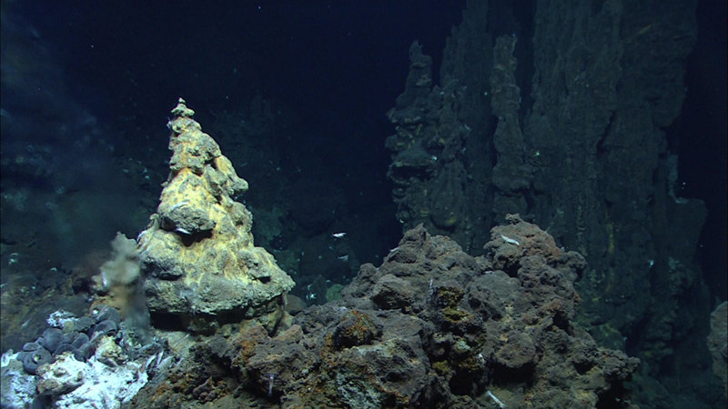
A great diversity of chimneys were seen at Mata Tolu. Image courtesy of Submarine Ring of Fire 2012: Northeast Lau Basin, NOAA-OER. Download larger version (jpg, 997 KB).
Today’s dive visited Mata Tolu (number three counting from south to north) in the Northern Mata volcano group. Morphologically, this is the youngest appearing of the seven N. Mata volcanoes, and it is the biggest and tallest of the group too, rising to a summit depth of 1820m. The volcano has a conical summit region and well-formed east-west trending rift zones that extend to either side of the summit, giving it a characteristic “eye“ shape (Mata means “eye“ in Tongan).
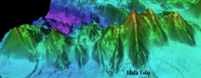
Side view of the N. Mata volcanoes at 2x vertical resolution. Mata Tolu is the third from the right. Image courtesy of Ken Rubin, University of Hawaii. Download image (jpg, 60 KB).
Our previous work with a towed camera and by dredging on three expeditions in 2010 and 2011 on the Univ. of Hawaii R/V Kilo Moana showed that the volcano had an active focused-flow hydrothermal system at its summit and was built of very young, fresh, crystal rich, boninitic volcanic rocks. The camera also imaged various vent organisms, so we knew that there was probably active hot springs at this site.
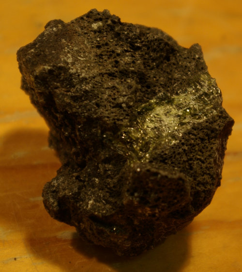
A huge (>1cm long) crystal of the mineral clinopyroxene from a very fresh volcanic rock sample we dredged from Mata Tolu in 2011. Image courtesy of Ken Rubin, University of Hawaii. Download larger version (jpg, 614 KB).
Armed with the above information, as well as suspected hydrothermal vent locations from CTD work by the NOAA Vents Program and a high-resolution bathymetric map collected in 2011 by an autonomous underwater vehicle (AUV), we aimed the Quest 4000 remotely operated vehicle (ROV) on a mission of discovery to the heart of a region of spires and pits at the very summit of the volcano.
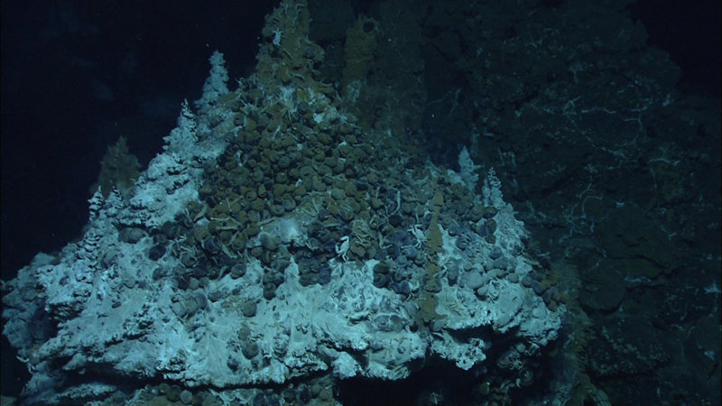
Snails cluster around the base of a hydrothermal vent chimney at Mata Tolu. Image courtesy of 222. Download larger version (jpg, 922 KB).
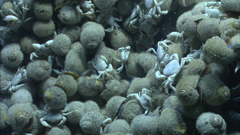
Close up of crabs and snails near chimneys at Mata Tolu. Image courtesy of 222. Download larger version (jpg, 992 KB).
Mata Tolu didn’t disappoint, showing us an array of beautiful features during our visit. After crossing young volcanic landforms on the steep south face beneath the summit, we reached the top and discovered an active hydrothermal system surrounded by a large area of currently inactive chimneys that covered an area roughly the size of an American football field. The site was veritable forest of active and inactive chimneys, some forming tall individual spires and others in clusters like the roof line of a gothic cathedral. Pockets of extensive biological colonization included crabs, snails, shrimps, fish, and worms around some of the chimneys.
This dive had something for everyone, and the ROV team showed their skill as usual, as they collected a wide array of geological, hydrothermal and biological specimens for the Submarine Ring of Fire Northeast Lau Basin 2012 Expedition team.