By Samuel Georgian, Ph.D Student - Temple University
July 19, 2012

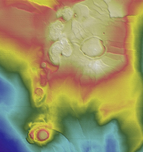
Sample bathymetry data mapping the features of the seafloor. Warmer colors indicate shallower regions. Image courtesy of Lophelia II 2012 Expedition, NOAA-OER/BOEM. Download image (jpg, 400 KB).
One of the issues facing deep-sea scientists is simply how – and where – to find our research subjects. The bottom of the seafloor covers an enormous area, and it’s just not feasible to search all of it. To narrow down the area we have to search, scientists can use environmental niche models.
Environmental niche models help scientists predict the location of organisms on the seafloor and to gain a better understanding of their niche, or the set of environmental conditions that they require for survival.
My research involves developing environmental niche models to determine what areas of the Gulf of Mexico are most likely to contain cold-water corals such as Lophelia pertusa. Lophelia is an important species of cold-water coral that produces a hard exoskeleton that many other species rely on for habitat. It is important for scientists to be able to understand where Lophelia might exist in unexplored areas and why it occurs where it does.
Most of the information that goes into environmental niche models comes from bathymetry data – basically a map of the features on the seafloor. Lophelia and other cold-water corals tend to grow on elevated features that receive faster currents – and therefore more food and oxygen. By just including bathymetry data in an environmental niche model, we can get a good idea of where we might find Lophelia. Including other environmental data – such as levels of dissolved oxygen, salinity, and temperature, provides an even better understanding of where Lophelia might be found.

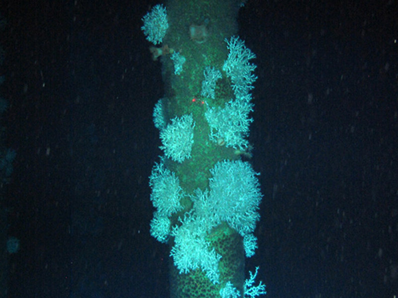
Lophelia pertusa thickets discovered growing on an oil platform during this cruise. Image courtesy of Lophelia II 2012 Expedition, NOAA-OER/BOEM. Download image (jpg, 900 KB).
This cruise is an exciting opportunity to collect more environmental data that can be used in models to help find Lophelia in other parts of the Gulf of Mexico. Attached to the remotely operated vehicle during each dive are a CTD (conductivity, temperature, depth) sensor and a dissolved oxygen probe.
Since the oil platforms that we are exploring on this cruise are elevated off the seafloor, we can exclude the effects of bathymetry and focus on other environmental factors that may affect where Lophelia is found – such as the temperature, salinity, and dissolved oxygen data collected by the CTD. This gives us a complete set of environmental data for the entire water column, and will greatly increase the amount of information we can include in models, improving our understanding of why Lophelia is found in some locations but not others.