By Dr. Sam Turner, Director of Archaeology - Lighthouse Archaeological Maritime Program
The search for the lost French fleet of Jean Ribault was carried out using a suite of three remote sensing instruments. These include a side scan sonar; a subbottom profiler; and a marine magnetometer, an instrument carried by many of the space probes launched at Cape Kennedy just to the south of the project area.

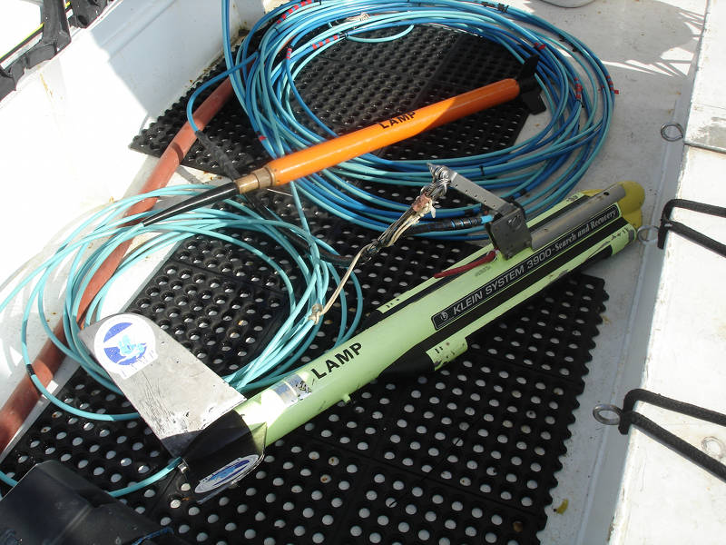
The orange magnetometer tow fish (above) and the side scan sonar tow fish (below) with their bundled tow-cables that carry power and data between the instruments and computers on the boat. Image courtesy of the Search for the Lost French Fleet of 1565. Download larger version (jpg, 2.9 MB).
The marine magnetometer, as the name implies, is a magnetometer designed and built specifically for marine applications. Like all other marine remote sensing equipment, the instrument has to be rugged and water proof in order to protect the sensitive electronics and power cables from salt water.
These electronics are built into a robust shell known as a tow fish, a term applied to any piece of equipment that is towed behind the survey vessel. The cable attaching the tow fish to the vessel carries the power for the instrument as well as relaying data to the onboard computer running the instrument.
The magnetometer is an instrument that detects and measures Earth’s magnetic field. Since our planet has a molten iron core, it produces a magnetic field that, among other things, allows us to use a compass to detect the magnetic north pole and also helps our planet retain its atmosphere. Any object that is made of iron, like our planet, produces a magnetic field. Such objects can also include cannons, anchors, iron cooking pots, or even the iron fasteners that hold an ancient ship’s hull together.
These iron objects, among others which lie within a shipwreck, have their own unique magnetic fields. As the magnetometer is towed behind the survey vessel, it measures Earth’s ambient magnetic field. This will vary between one to five nanoteslas (the unit of measure for magnetic fields), or gammas. As the magnetometer approaches a submerged iron object such as a cannon or an ancho,r the magnetometer detects its individual field. These readings are known as anomalies because they stand out of the ambient magnetic field and can vary in strength from anywhere between six to many thousand gammas.
This tool is perhaps the most important of the three remote sensing instruments because it can detect anomalies that lie buried and completely obscured by the seabed.
The side scan sonar is an instrument that emits sound from two transducers that are built into the side of the side scan tow fish. The sound travels from the sides of the tow fish to the seabed and is then reflected back to the side scan which takes the data and essentially renders an image of the seabed. All objects, such as a stone outcrop, coral heads, or shipwreck debris that stick up above the seabed can be seen and flagged for investigation.
The records from this instrument can be mosaiced together to form a sort of collage of the seabed that is representative of the entire project area.

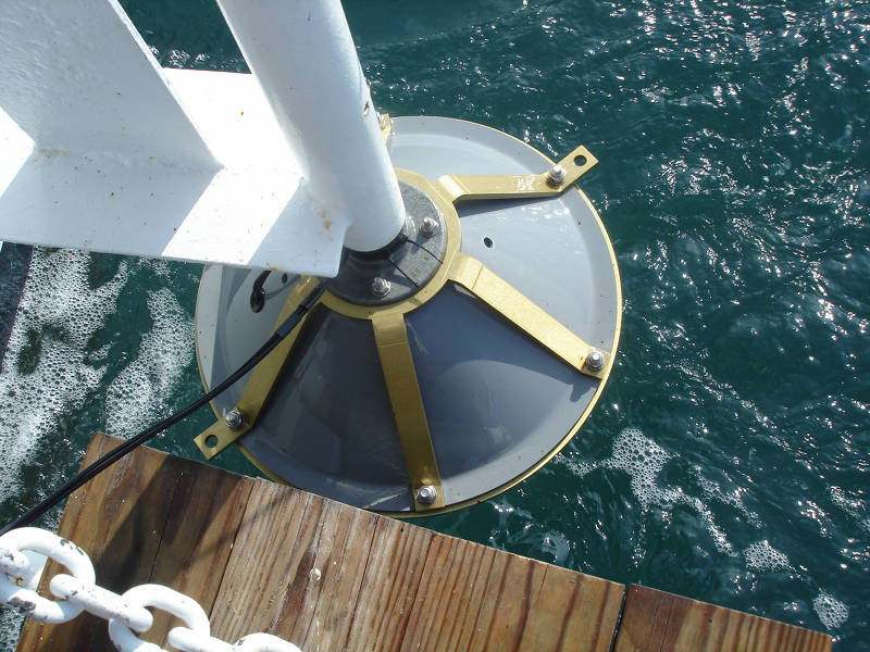
The subbottom profiler instrument shown in its bracket on the R/V Roper in the retracted position. Image courtesy of the Search for the Lost French Fleet of 1565. Download larger version (jpg, 3.2 MB).
The third instrument in the remote sensing suite is the subbottom profiler. Like the side scan sonar, this instrument uses sound. However in the case of the subbottom profiler, it fires a very low-frequency pulse of sound directly at the seabed below the survey vessel. Part of this pulse is reflected back to the instrument by the seabed itself while part of the pulse continues until it encounters another stratigraphic layer of sediments which in turn reflects another part of the pulse back to the instrument and so on.
Some instruments can provide very deep penetration of the seabed to render what essentially looks like a cross section of the ocean floor revealing all the different strata of sediments and soils. If the instrument were to pass directly over a shipwreck buried in the seabed, this would appear as a very isolated lens of sediment rather than a continuous layer of sediment laid down by a geologic event or over time.
All the information that these instruments gather, however, would be useless without a means to precisely locate the features detected. All these instruments utilize GPS satellite navigation to provide very precise positioning. This is the glue that holds all our findings together.