By John Gray, University of South Florida

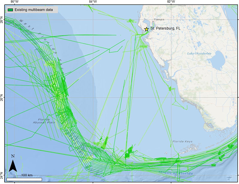
Map of the shelf and slope off the west coast of Florida showing areas that have previously been mapped using multibeam echosounders (in green). Much of the area has yet to be mapped and will be mapped for the first time during the present expedition aboard NOAA Ship Nancy Foster. Image courtesy of Daniel Wagner/NOAA. Download larger version (jpg, 850 KB).
Oceanographers are modern day explorers, as the vast majority of the ocean floor remains to be mapped at a high resolution. Using multibeam echosounders, oceanographers map areas of the ocean floor to support their research, particularly areas that have never been mapped before. Located about 150 miles off St. Petersburg, Florida, the West Florida Shelf is mostly unknown, as a large portion of the area remains to be mapped.
These poorly known seafloor habitats support a huge variety of marine life, including commercial and recreational fish, deep-sea corals, turtles, sponges, sand dollars, and many more. Detailed seafloor maps provide the unifying context for all types of oceanographic studies, including studies of the water above the seafloor, the flora and fauna on the seafloor, and the seafloor itself.
One example of how detailed maps support research is the current expedition. The primary goal of this expedition is to study deep-sea coral ecosystems on the West Florida Shelf using a deep-sea remotely operated vehicle (ROV) in conjunction with mapping operations. The target study sites are all thought to have environmental conditions that support extensive deep-sea coral populations and were identified based on previously collected multibeam bathymetry data in the area.
On this expedition, these areas will be explored visually using ROVs, many for the very first time. Additionally, the expedition will collect high-resolution bathymetry data in surrounding areas that have never been mapped before, and thereby will add valuable new information to the slowly growing bathymetry map of the West Florida Shelf.
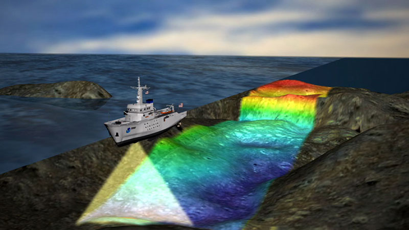
The instruments that are used to map the seafloor are called multibeam echosounders, which are attached to the hull of research vessels like NOAA Ship Nancy Foster. A multibeam echosounder emits beams of sound that hit the seafloor and are then reflected back towards the ship, where sensors on the hull record the reflected acoustic signal. To determine depth, the two-way travel time of each beam of sound is measured. Depth is then calculated from the travel time and the speed of sound in the water.

Multibeam echosounders map the seafloor by emitting a beam of sound from the hull of the ship and recording the sound signal after it is reflected off the seafloor. Based on the time elapsed between when the sound is emitted and when it is recorded, oceanographers can determine the depth of the seafloor. Additionally, the intensity of the reflected sound signal can be used to the determine the hardness of the seafloor, which is indicative of the type of habitat that is found on the seafloor. Image courtesy of NOAA. Download larger version (jpg, 175 KB).
While single-beam echosounders, which are found on many recreational and commercial vessels, provide the depth directly below the ship, a multibeam echosounder provides depths in a continuous swath from directly below the ship up to 70 degrees to either side. The triangle formed by this swath gets bigger with deeper water, allowing for greater coverage of the seafloor. To achieve full coverage of a survey area, the ship must go back and forth along carefully spaced lines, much like mowing a lawn.
In addition to bathymetry data, multibeam echosounders can also collect backscatter data. Backscatter is how much energy from each sound beam is reflected off the seafloor and returned back to the ship. To put it another way, backscatter data is essentially the loudness of the echo that is reflected off the seafloor. This information is useful for identifying different bottom types, such as hard bottoms like coral reefs or soft bottoms like sand or mud flats.

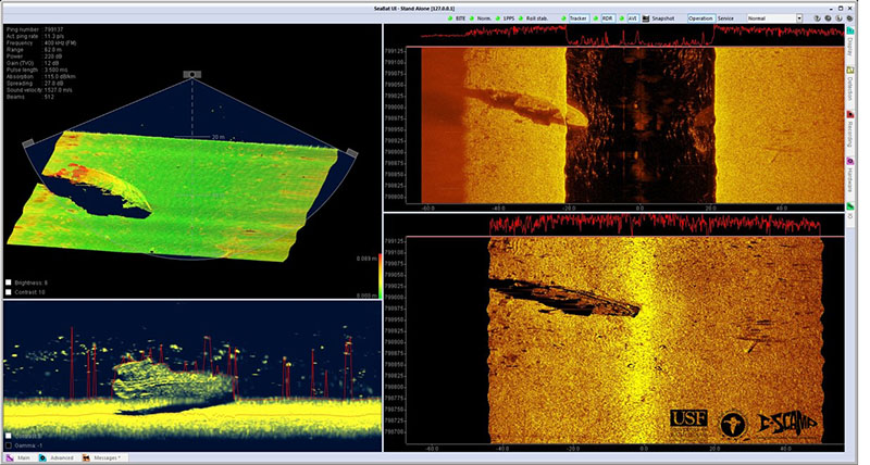
Examples of real-time maps produced by multibeam echosounders during a previous expedition that mapped Pinellas II, an artificial reef that is part of the Pinellas County artificial reef program. The maps show the sunken tugboat Sheridan at the bottom of the seafloor. Image courtesy of John Gray/USF-CSCAMP. Download larger version (jpg, 706 KB).
The present expedition will collect both backscatter and bathymetry, thereby supporting the overall mission of characterizing deep-sea coral ecosystems of the Southeast United States.