 a multibeam echosounder on NOAA Ship Nancy Foster and B) the NOAA Coastal Relief Model. Color indicates depth, with red showing shallower areas and blue for deeper areas. Note that the mound and ledge features explored by the remotely operated vehicle Odysseus, operated by Pelagic Research Services, on this expedition are discernible in the high-resolution data depicted in A but not in the moderate-resolution data depicted in B. The illustrated area includes three proposed Habitat Areas of Particular Concern: a) Long Mound, b) North Reed, and c) Many Mounds.")
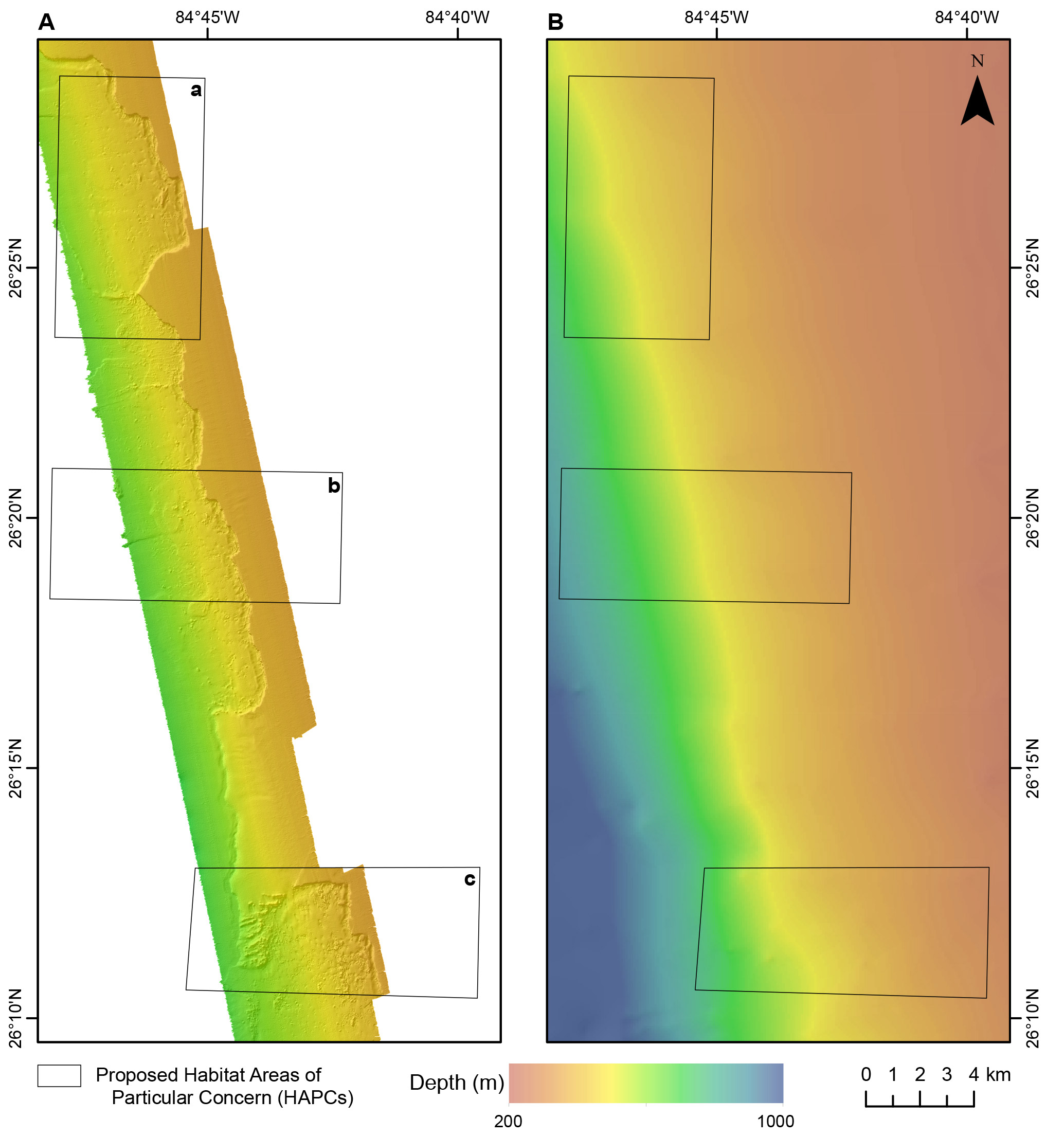
Map comparing depth information along the West Florida slope collected from A) a multibeam echosounder on NOAA Ship Nancy Foster and B) the NOAA Coastal Relief Model. Color indicates depth, with red showing shallower areas and blue for deeper areas. Note that the mound and ledge features explored by the remotely operated vehicle Odysseus, operated by Pelagic Research Services, on this expedition are discernible in the high-resolution data depicted in A but not in the moderate-resolution data depicted in B. The illustrated area includes three proposed Habitat Areas of Particular Concern: a) Long Mound, b) North Reed, and c) Many Mounds.