
By Amanda Evans, Coastal Environments, Inc.
Louise Tizzard, Wessex Archaeology Ltd.
Mobilization is the act of getting a vessel and its crew ready to sail. We took a photo that can be best described as “happy scientists about to leave port,” but it seems dishonest to imply that we’re doing this alone.
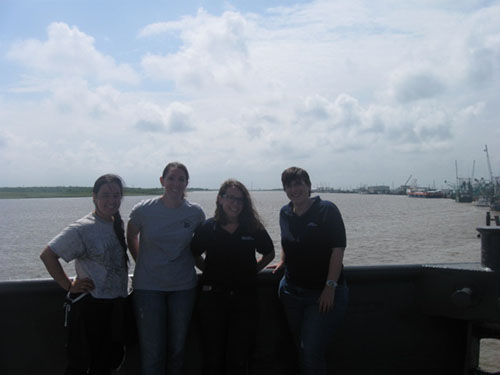
The scientific crew. From left to right: Alex Herrera-Schneider and Amanda Evans (Coastal Environments) and Megan Metcalfe and Louise Tizzard (Wessex Archaeology). Image courtesy of Paleolandscapes and the ca. 8,000 BP Shoreline of the Gulf of Mexico Outer Continental Shelf. Download larger version (jpg, 129 KB).
Have you ever wondered what goes into doing science at sea? Let us tell you what it took to get our equipment survey mobilized and off the dock. Our mobilization was fairly simple. The vessel we’re using, Research Vessel Nikola, is a commercial survey boat, fully equipped with most of the sensors we plan to use; we only needed to add four scientists and two pieces of remote sensing equipment. Since the boat is a full-time working vessel, our mobilization date was more like a moveable date range. The closer we got, the smaller the range became. We finally set the date and time to go to the dock with 36 hours advance notice.
We brought a parametric sonar system and a motion reference unit to install on the boat. The parametric sonar works from a fixed position. In our case, this meant attaching it to the end of a pole on the side of the ship which is lowered into the water during survey. The boat already had an over-the-side mounted pole, but with an existing sensor mounted on it. To remove the existing sensor, which weighs 200 pounds, we needed a work barge that can sit next to the ship but below the pole, and a crane to hold the sensor once it’s unbolted.
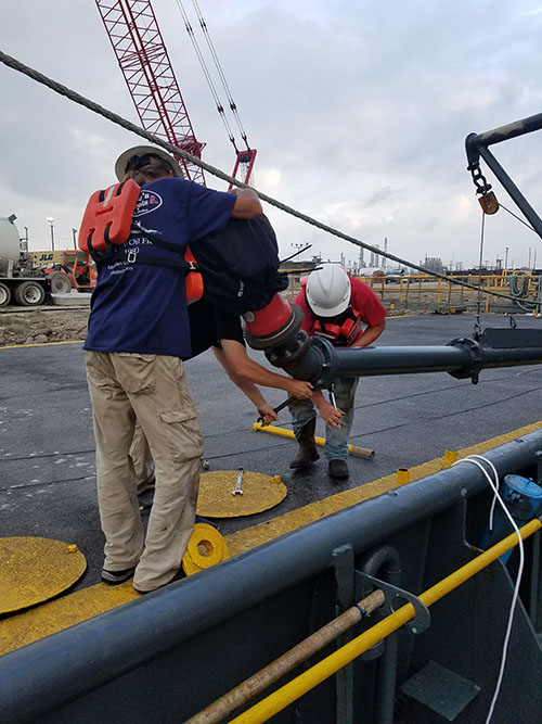
Working from a barge, the crew remove an existing sensor from an over-the-side mounted pole that will be used for the parametric sonar system. Image courtesy of Paleolandscapes and the ca. 8,000 BP Shoreline of the Gulf of Mexico Outer Continental Shelf. Download larger version (jpg, 5.9 MB).
The crane then lifted the sensor safely onto the deck for stowage. Next, we had to attach the new sensor. We had to arrange for welders to make a new flange adapter because the 170-millimeter bolt pattern on the sensor was too small to securely attach to the receiving bolt pattern on the pole’s 6-inch flange. Taking care not to mix up metric and imperial measurements was key!
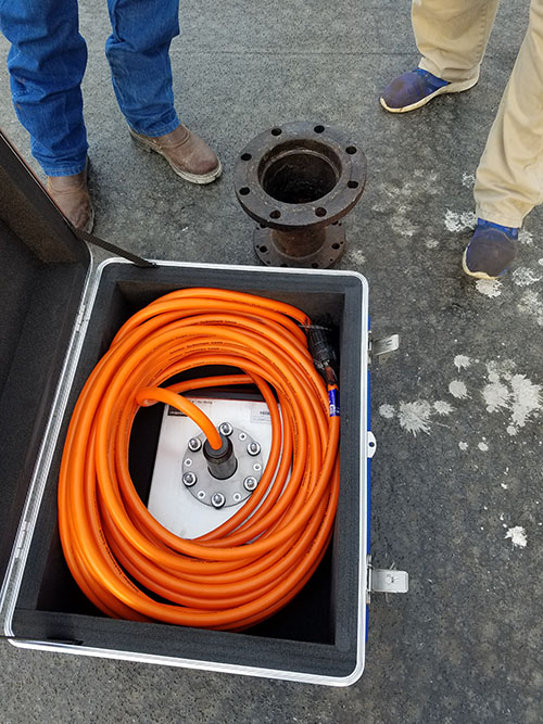
The parametric sonar sensor and data cable (in box) with the flange adapter that will be cut and welded to fit the sensor’s bolt pattern. Image courtesy of Paleolandscapes and the ca. 8,000 BP Shoreline of the Gulf of Mexico Outer Continental Shelf. Download larger version (jpg, 7.8 MB).
We mounted the new sonar on the existing pole using the new adapter flange, then had to run 20 meters of data cable from the sensor up through the pole, out the top of the pole, over the ship’s back deck, and inside the boat so that we could connect it to the computer that controls the sensor. Similarly, the motion reference unit was securely installed and cables were run and connected into the parametric sonar computer to provide measurements on the movement of the pole during survey. Since we’re mapping, we need location data. The boat already has a navigation antennae and cables to run the DGPS (differential global positioning system) data into the other remote sensing computers. We split one more cable off of that cord and connected it to our sensor’s computer.
What about power? The boat already has generators and battery backups; we plugged into an existing surge-protected outlet. Once that was set up, it was time to test the equipment and make sure all the equipment worked and all data strings were talking to each other. Once sorted, we were ready to leave port and head to site.
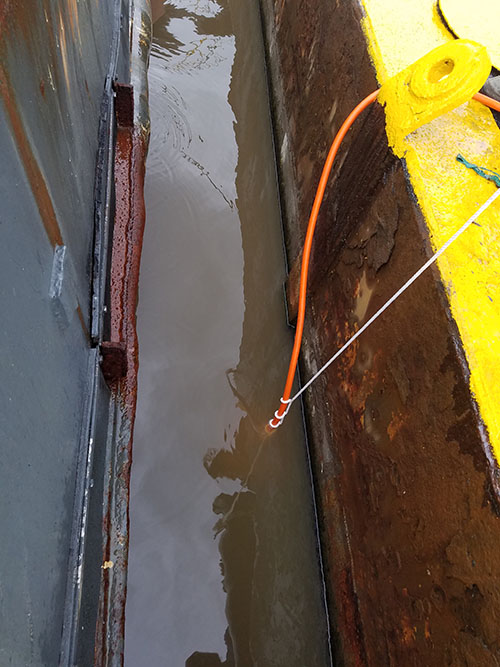
“Wet testing” the parametric sonar. Image courtesy of Paleolandscapes and the ca. 8,000 BP Shoreline of the Gulf of Mexico Outer Continental Shelf. Download larger version (jpg, 5.3 MB).
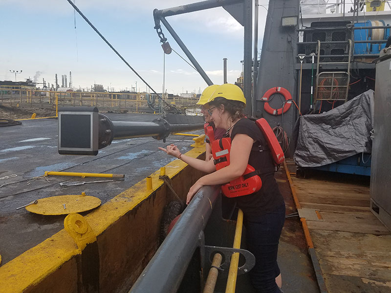
Metcalfe (front) and Tizzard (back) giving the installed parametric sonar system a final check. Image courtesy of Paleolandscapes and the ca. 8,000 BP Shoreline of the Gulf of Mexico Outer Continental Shelf. Download larger version (jpg, 5.8 MB).
This is the path we had to take to physically put two pieces of equipment on a boat in a way that would allow us to collect data. Imagine we were bringing a full set of remote sensing gear to a boat that wasn’t already outfitted for survey—it would have taken several days to mount all of the gear, figure out how to safely get the sensors in and out of the water, run the cables, source the power, and solve all of the little problems that always seem to pop up. We planned for every “what if” we could think of and still had to answer multiple calls of “we’ve got a problem” during our “simple” mobilization. It takes a team to do science offshore, and we’re incredibly thankful to ours.
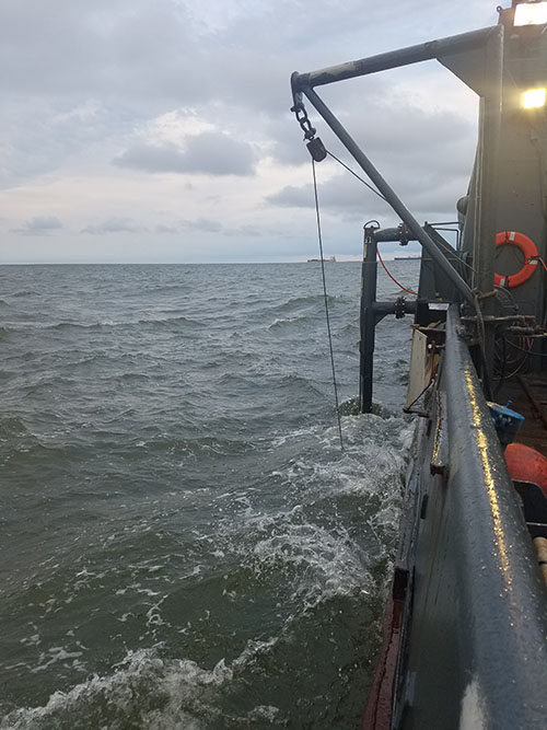
The parametric sonar pole deployed during data collection. Image courtesy of Paleolandscapes and the ca. 8,000 BP Shoreline of the Gulf of Mexico Outer Continental Shelf. Download larger version (jpg, 5.8 MB).
With sincere thanks to David, James, Cory, Dave, Gilbert, Kelvin, Darren, Kelvin, Scott, and Scott from the R/V Nikola; Pete, Steve, Donald, Matt, and CD at Echo Offshore; Erin, Rich, Gus, Idalia, and Beth at CEI; Paul and Jane at Wessex Archaeology; and Frank, Matt, Emily, Joyce, Nathalie, and Yvette at the NOAA Office of Ocean Exploration and Research. We wouldn’t be here without you.