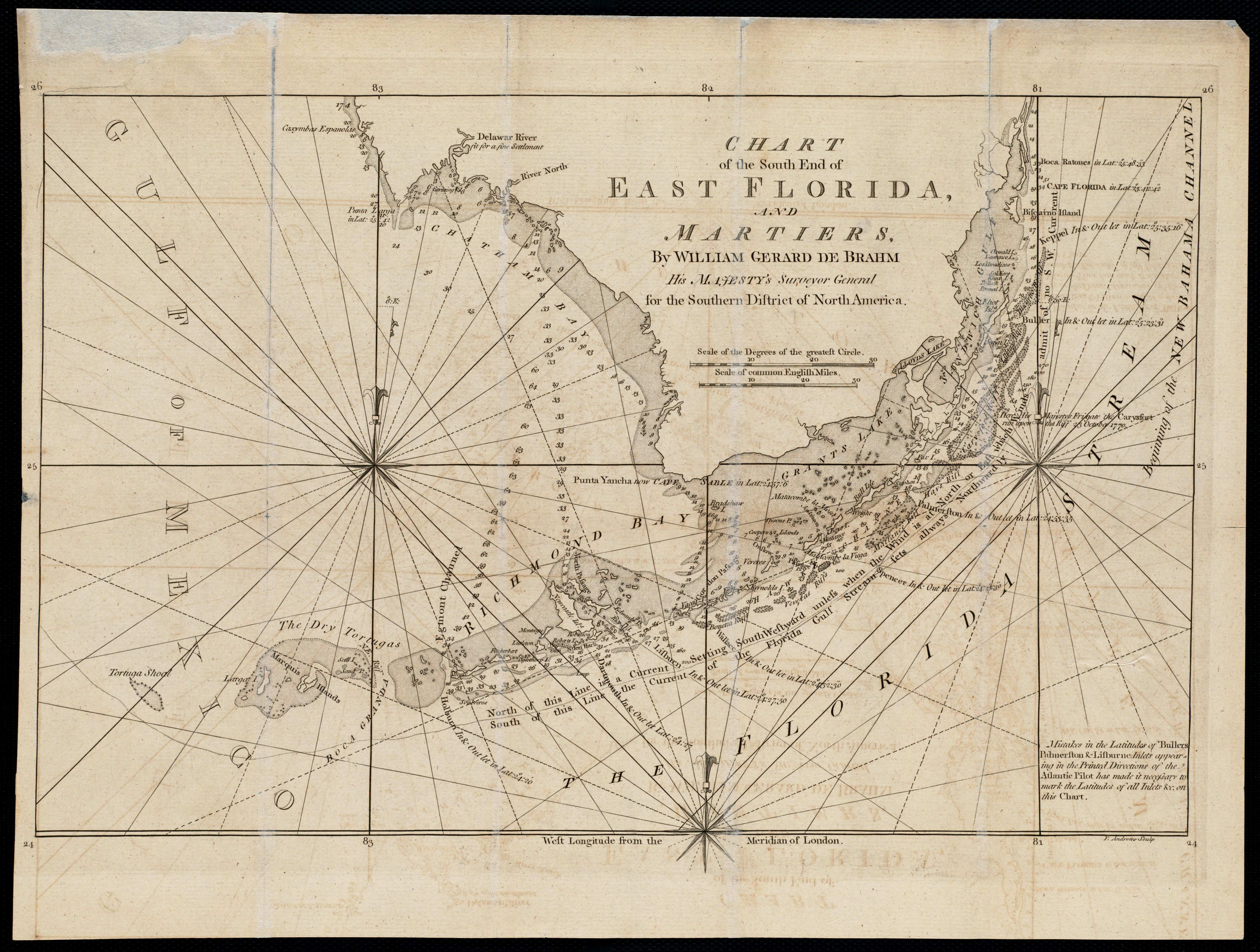
British chart from 1771 illustrating the limited information available at that time to accurately chart the western end of the Florida Keys.
