Escanaba Trough: Exploring the Seafloor and Oceanic Footprints
May 26 - June 14, 2022
Marine Geology in Escanaba Trough
Escanaba Trough is the southern-most segment of the Gorda Ridge seafloor spreading center, the only mid-ocean ridge located within the US Exclusive Economic Zone. Several geomorphic and geochemical characteristics set Escanaba Trough apart from most of the Juan de Fuca Plate-Gorda Plate mid-ocean ridge plate boundary.
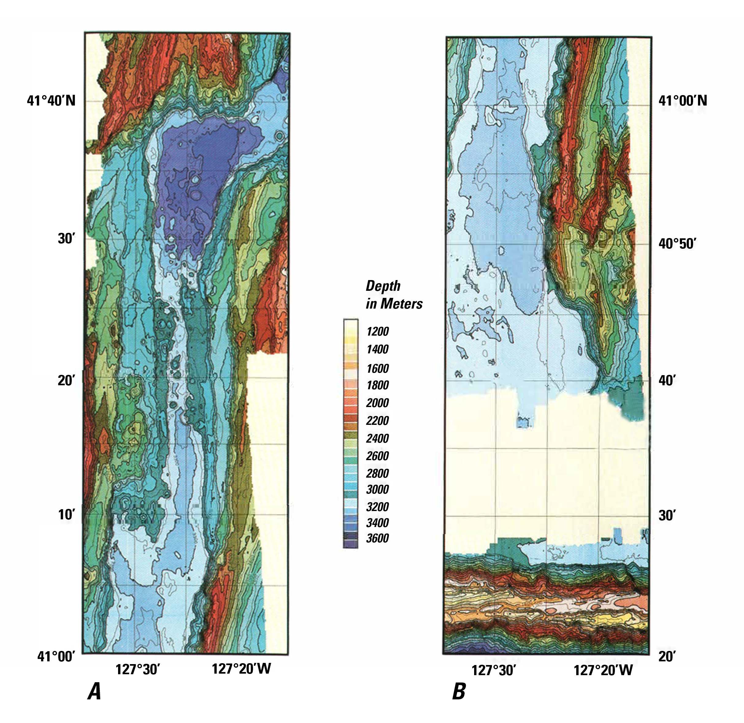
Escanaba Trough is a slow-spreading (about 24 millimeters a year) ridge with a morphology typical of the Mid-Atlantic Ridge, with a 3,300-meter-deep axial valley bounded by steep normal faults. Although the spreading center is located a long way from the continental margin, the valley is filled with sediment that is around 500 meters deep in the area where we will be working.
The sediment was delivered in a series of glacial outburst floods from the Columbia River drainage, the most recent of which were the Missoula Floods between 15,000 and 13,000 years ago. These flows of sediment, called turbidity currents, traveled southward more than 1,100 kilometers from the mouth of the Columbia River in a meandering seafloor channel system, eventually hitting the topographic barrier formed by the Mendocino Escarpment and turning northward into the axial valley of Escanaba Trough, which confined the dense sediment flows.
As the turbidity currents “froze” in the box canyon of the axial trough, they dropped their sediment load, forming thick layers of sandy and silty deposits. Although the Escanaba Trough is still actively spreading and forming new oceanic crust, volcanic rocks are rarely erupted at the seafloor, so most of the bottom is covered by mud.
Basaltic magma is denser than sediment, which prevents it from rising to the seafloor and erupting over the sediment as lava. Most of the igneous activity occurs by intrusion of magma into the sediment, forming basaltic sills and laccoliths that underlie uplifted sediment hills.
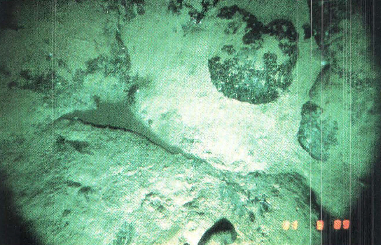
Seawater circulating through faults interacts with hot basaltic rocks at depth and locally vents to the seafloor, forming hydrothermal deposits of massive sulfide. Interaction of the hydrothermal fluids with the sediment changes their composition, such that the vents at sediment-covered spreading centers have distinctive compositions compared to “black smoker” fluids that form massive sulfide deposits at bare-rock mid-ocean ridges.
The massive sulfide deposits at Escanaba Trough are dominantly composed of the mineral pyrrhotite (FeS) with variable amounts of copper and zinc sulfides and barite (BaSO4). Research conducted in the 1980s by USGS also recovered some unusual polymetallic sulfides, which were highly enriched in Au, Au, Pb, As, Sb and other rare metals that were collected by dredging the seafloor. This early work was conducted prior to the availability of GPS navigation, at a time when multibeam seafloor mapping was still a classified technology. The technology and maps available at the time severely limited what could be learned about the seafloor, and the exact source of the polymetallic sulfides is still unknown.
Dives conducted in 1988 by the research submersible Alvin were the first to document active hydrothermal venting, along with associated chemosynthetic-based animal communities, at a site in northern Escanaba Trough where 220-degree Celsius (430-degree Fahrenheit) hydrothermal fluids were collected and analyzed.
In 2014 the Monterey Bay Aquarium Research Institute collected the first high resolution (meter-scale horizontal, centimeter-scale vertical) multibeam sonar maps, which reveal details not seen before, including more that 100 hydrothermal chimneys that have never been sampled.
Our expedition will be the first to conduct submersible dives in the area since those maps became available. Guided by the new maps, we are excited to utilize techniques not available when the area was last visited by submersible. Much remains to be discovered, including how the hydrothermal system and the biological communities have changed in the 34 years since the active hydrothermal vents were first discovered, as well as in the 17 years since they were last seen and sampled.
By Rob Zierenberg, Co-Principal Investigator, Emeritus Professor of Geology, University of California - Davis
Published June 3, 2022
Re-posted with permission from original article.