Early Encounters on a Western Frontier: The Search for Svyatoy Nikolai (1807-1808)
Surveying the Seafloor, Past and Present
Today’s seafloor surveys and the maps that result are vital for navigation, environmental studies, resource management, natural disaster preparedness, and the detection and management of maritime heritage resources, like those sought during this project in Olympic Coast National Marine Sanctuary. From manual lead lines to modern remote sensing instruments like sonars and magnetometers, the tools and techniques used to conduct these surveys have come a long way, and they continue to evolve.
In the Beginning: Lead-Line Surveying
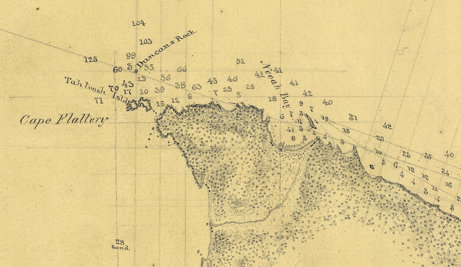
Early seafloor surveyors were focused on navigation and relied on depth soundings to measure depth. This entailed the use of a lead line, a simple implement consisting of a rope, usually marked at regular intervals (e.g., every six feet), with a lead weight attached to its end. To take a measurement, a surveyor threw the weight overboard and allowed it to sink to the seafloor. Using the marks on the rope as a scale, they then gauged depth based on how much of the line was submerged and were able to discern obstacles and safe routes for passage.
While lead lines were vital navigation tools for centuries — they were the primary tool used to measure depth until the early 20th century — depth sounding was time and labor intensive and only provided data at specific points, rather than as a continuous profile, which limited their use.
Today’s Approach: Remote Sensing
Today’s remote sensing technologies, while more costly and complex, have greatly advanced our ability to survey the seafloor, as well as the sub-seafloor and water column, for navigational purposes and much more. Broadly speaking, remote sensing includes all technologies that allow researchers to observe things at a distance, without the need to physically engage with the subject of their study. This includes submersible devices like sonar, magnetometers, and remotely operated vehicles as well as above-water technologies like airborne Lidar, drone photography, and satellite imagery.
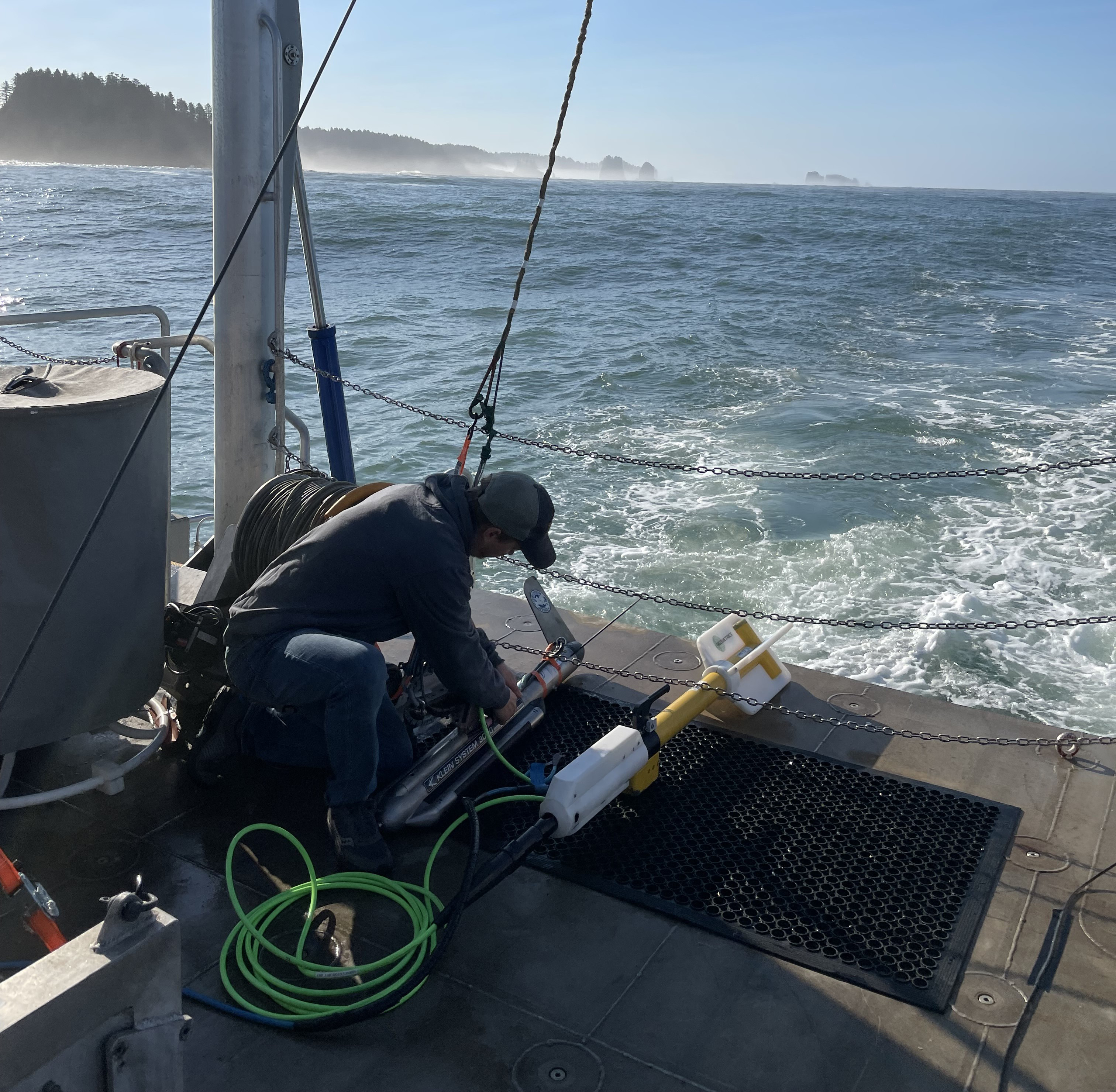
Like most oceanographic science, contemporary underwater archaeological work is reliant on remote sensing technologies. For this project, we used side-scan sonar, multibeam sonar, and a magnetometer to search for and explore shipwrecks in the Olympic Coast National Marine Sanctuary.
Side-Scan Sonar
Side-scan sonar uses sound waves to help us understand what’s on the seafloor. It works by sending out acoustic pulses (or "pings") from a device towed near the water's surface. After sound waves hit the seafloor, they bounce back to the sonar equipment. With these returned signals and a variety of computer programs, surveyors can produce detailed images of the seafloor and objects lying on or slightly beneath it. These high-resolution images show texture and objects, but not depth. Thus, side-scan sonar is most commonly used to detect and identify submerged features like shipwrecks.
Multibeam Sonar
Multibeam sonar also uses sound waves to map and visualize the seafloor and submerged objects. It works by emitting a fan of sound beams directly beneath a vessel, covering a broad swath of the seafloor. Each beam returns the ocean’s depth at a specific point, resulting in a dense map of highly accurate measurements. Multibeam sonar is used primarily to determine the depth and shape of the seafloor for the production of detailed bathymetric maps (3D maps of underwater terrains). While shipwrecks and the like may be detected by multibeam sonars, they provide less detail and are used less frequently than side-scan sonars for archaeological purposes. During this project, we used multibeam sonar to identify potential hazards to our research vessels and divers.
Magnetometer
A magnetometer relies on Earth’s magnetic field to detect anomalies that may indicate the presence of objects, including submerged maritime resources. Changes in the strength of the background magnetism can be caused by the presence of iron or steel objects often used in the construction of ships — Svyatoy Nikolai, the primary target of this project, featured iron in its construction. A towed magnetometer can be indispensable when searching for objects that may be buried, or otherwise obscured (e.g., by kelp beds), and therefore don’t appear in sonar data.
Collectively, this technological trio provided this project team with the remote sensing power needed to conduct a safe and successful search. The remote sensing data we generated can be used by multiple disciplines to better understand the geology, ecology, and history of the waters surrounding La Push and the Quillayute River.
By Dayan Weller, East Carolina University
Published November 6, 2023