

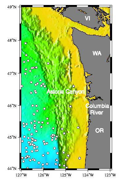
Map view of the bathymetry and earthquakes (white dots) located near Astoria Canyon and the surrounding continental margin. Yellow-shaded bathymetry represents areas where the sea floor is less than 1,000 m deep; green = 1,000-2000 m deep; blue, more than 2,000 m deep. The 79 earthquakes shown in this map occurred between August 1991 and January 2001, and were located using the U.S.Navy's SOSUS hydrophones. VI = Vancouver Island, WA = Washington, OR = Oregon. Image courtesy of Lewis and Clark 2001, NOAA/OER.