

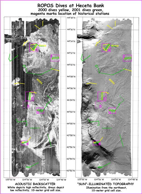
Heceta Bank Simrad EM 300 backscatter (left) and topography (right). Grids for both images are 10 meters. ROPOS ROV dive tracks 2000 (yellow) and 2001 (green) overlay imagery. The backscatter image reveals seafloor physical properties and texture of the seabed. White areas depict high reflectivity (cobble, boulder and sand). Black areas depict low reflectivity (mud). The topography image is "illuminated" from the northwest. The shelf break is apparent on the southwest portion of the bank. Ridges, folds and jointed bedding planes are easily discerned on the shallow portions of the bank. Image courtesy of Lewis and Clark 2001, NOAA/OER.
Related Links
Lewis and Clark Legacy: Summary of Heceta Bank (Phase 3 of the Expedition)