
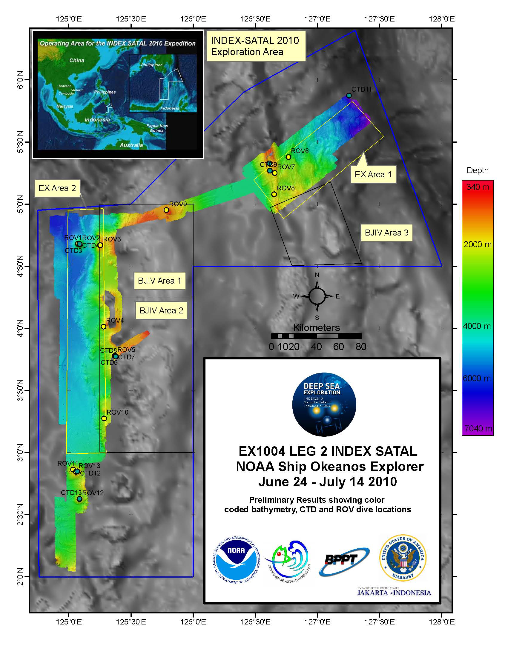
This map shows areas mapped as well as the locations of CTD casts and ROV dives during Leg II. Image courtesy of the NOAA Office of Ocean Exploration and Research, INDEX-SATAL 2010. Download larger version (jpg, 1.3 MB).
This map shows areas mapped as well as the locations of CTD casts and ROV dives during Leg II. Image courtesy of the NOAA Office of Ocean Exploration and Research, INDEX-SATAL 2010. Download larger version (jpg, 1.3 MB).
Today marks the end of INDEX-SATAL 2010 Leg II. The NOAA Ship Okeanos Explorer returned to Port in Bitung, Indonesia at approximately 0900. The crew will spend the next few days finishing outstanding tasks from Leg II and preparing to head back to sea on July 21 to start Leg III.