Bathymetry Data
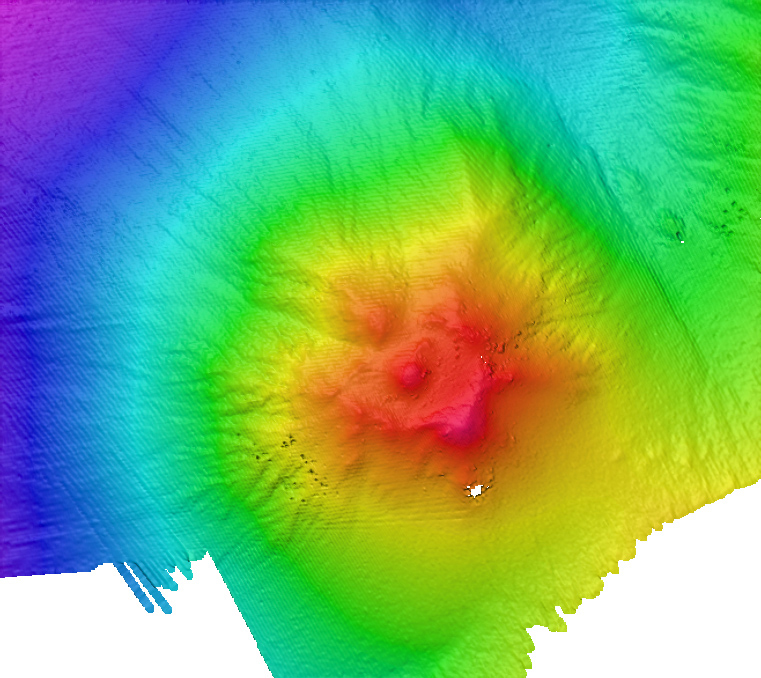
Multibeam image of one of the volcanoes mapped during the INDEX-SATAL 2010 expedition. After imaging an interesting feature such as a submarine volcano with the multibeam sonar, the team will deploy the Little Hercules remotely operated vehicle to the seafloor to collect imagery so that scientists examining the footage can “characterize” the site. Enough information about the site is collected to ask interesting questions, but exploration entails moving on to explore another site instead of lingering on to answer those questions.
