Operating Area
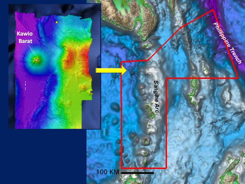
Image showing a map of the INDEX-SATAL 2010 operating area made using data from a satellite in space that can reveal features like large submarine volcanoes and ocean trenches (right). Areas of interest can be explored in greater detail by collecting data to create more detailed maps, like the one to the left showing multibeam data acquired via NOAA Ship Okeanos Explorer.
. Areas of interest can be explored in greater detail by collecting data to create more detailed maps, like the one to the left showing multibeam data acquired via NOAA Ship Okeanos Explorer.")