
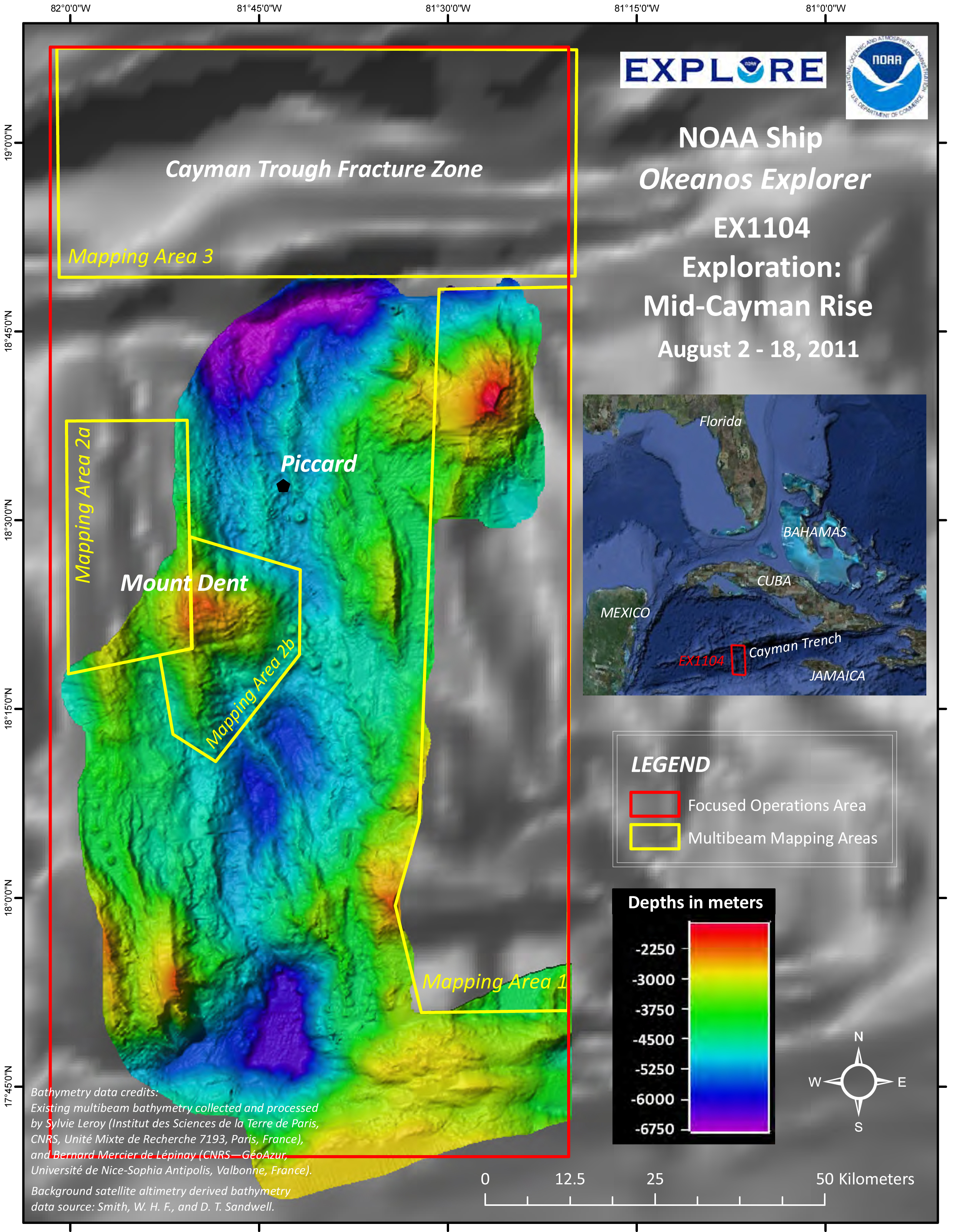
Map showing the operating area for the 2011 Mid-Cayman Rise Exploration. This expedition will focus on the shallow outer “walls” of the ridge – using seafloor mapping, water column investigations for tell-tale chemical signals of nearby venting, and detailed ROV observations.