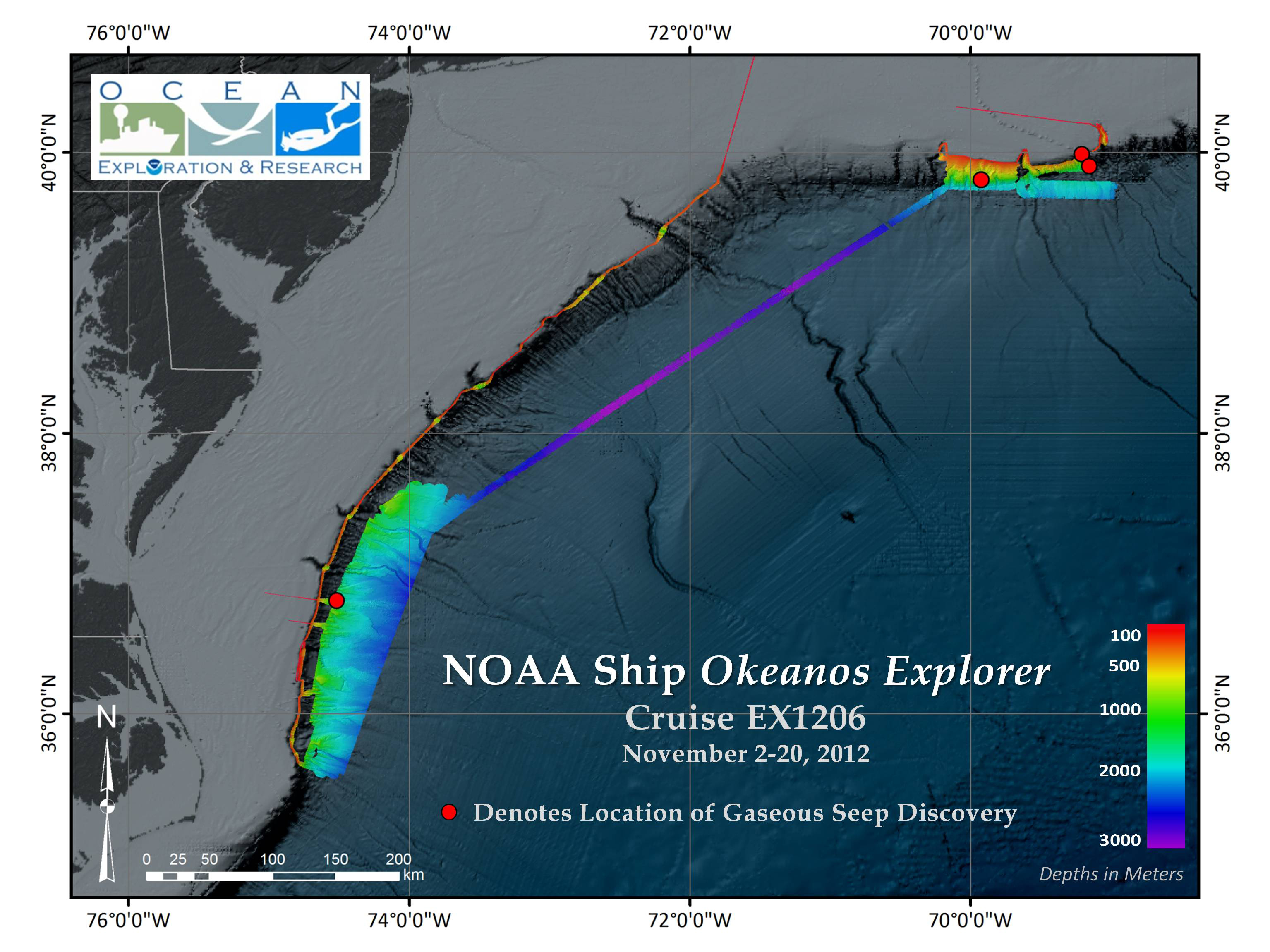
Map showing bathymetric data collected along the U.S. Atlantic coast. The locations of seafloor gaseous seep discoveries between 147 and 163 kilometers off shore, with one site east of Cape Henry, Virginia, and two sites south and southeast of Nantucket Island, Massachusetts (at water depths of 300 to 1,600 meters) are indicated with a red circle.
Download larger version. are indicated with a red circle.")