Educators and scientists working with NOAA developed two lesson plans for students in Grades 6-8 and 9-12 that are tied to the science behind the Northeast U.S. Canyons Expedition 2013. These lesson plans support the Next Generation Science Standards in the context of cutting-edge ocean exploration and research using state-of-the-art technologies. Activities also support the Ocean Literacy Essential Principles and Fundamental Concepts , and include focus questions, background information for teachers, links to interesting Internet sites, and extensions. Daily logs that document the latest discoveries and complement the lesson plans, complete with compelling images and video, will be sent back each day from sea. Teachers are encouraged to use the background essays, logs, and other resources from the Northeast U.S. Canyons Expedition 2013 posted on this site to supplement the lesson plans.
Read a description of each lesson plan and/or download them to your computer. All of the lesson plans are available in a PDF format, and may be viewed and printed with the free Adobe Acrobat Reader. To download a lesson plan, click on its title from the listing below. (Note: if you have problems downloading one of these lessons, right-click on the link and save the lesson to your desktop.)
Grade Level: 5-12
Focus: How students can become active ocean explorers while viewing live video feeds during Okeanos Explorer expeditions (Physical Science/Earth Science)
Students learn how to access the Ocean Explorer website and access a live video feed of an Okeanos Explorer expedition; explore along with the ocean science community via live feeds during Okeanos Explorer expeditions; and learn how to track an expedition using the Okeanos Atlas.
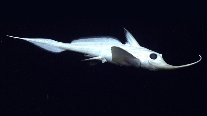
Grade Level: 6-8
Focus: Biological organisms in cold seep communities (Physical Science/Life Science)
Students obtain, evaluate, and communicate information about flows and cycles of energy in cold seep ecosystems; develop a model that describes some of the interdependent relationships in cold seep ecosystems; and develop and use a model to explain states and changes between states of methane hydrates.
Grade Level: 9-12
Focus: Multibeam sonar
Students explain how multibeam sonar uses the properties of sound waves in water for scientific research about topography of the ocean floor; and analyze and interpret multibeam sonar data using free iview4D software to identify patterns in the distribution of seafloor features that contribute to scientific research about large-scale interactions in Earth’s systems.
For other lessons and information that may be relevant to your classroom instruction associated with this expedition, visit the NOAA Ocean Explorer website lesson search page at http://oceanexplorer.noaa.gov/edu/lessonplans/lessonplans.html. Enter keywords such as: canyons, methane seeps, gas hydrates, seamounts, deep-sea corals, bathymetry, benthic habitats, and underwater robots.
To further explore the technologies of bathymetric mapping, water column exploration, and ROV imagery, try the following lessons:
(from the NOAA Ship Okeanos Explorer Gulf of Mexico 2012 Expedition)
Grade Level: 5-12
Focus: Multibeam sonar data and exploration activities during the NOAA Ship Okeanos Explorer Gulf of Mexico 2012 Expedition missions (Earth Science)
Students describe multibeam sonar, explain why the velocity of sound in water must be measured before maps can be created with the Okeanos Explorer’s multibeam sonar system, discuss the advantages of multibeam sonar bathymetry compared to two-dimensional topographic bathymetry, and interpret three-dimensional multibeam data of underwater features mapped by the Okeanos Explorer.
(from the NOAA Ship Okeanos Explorer Gulf of Mexico 2012 Expedition)
Grade Level: 5-12
Focus: Multibeam sonar data interpretation (Earth Science)
Students interpret three-dimensional multibeam data of underwater features mapped by the Okeanos Explorer during the Gulf of Mexico 2012 Expedition.
(from the NOAA Ship Okeanos Explorer Gulf of Mexico 2012 Expedition)
Grade Level: 5-12
Focus: CTD data and exploration activities during the NOAA Ship Okeanos Explorer Gulf of Mexico 2012 Expedition (Physical Science/Earth Science)
Students define "CTD" and explain how this instrument is used aboard the Okeanos Explorer; explain how relationships between temperature, salinity, pressure, and density in seawater are useful to ocean explorers; and use data from the Okeanos Explorer to create and interpret graphs of temperature, salinity, and depth.
(from the NOAA Ship Okeanos Explorer Gulf of Mexico 2012 Expedition)
Grade Level: 5-12
Focus: CTD data interpretation (Earth Science)
Students interpret CTD data collected by the Okeanos Explorer during the Gulf of Mexico 2012 Expedition.
(from the NOAA Ship Okeanos Explorer Gulf of Mexico 2012 Expedition)
Grade Level: 5-12
Focus: ROV imagery and exploration activities during the NOAA Ship Okeanos Explorer Gulf of Mexico 2012 Expedition (Earth Science)
Students will describe typical applications and limitations of imagery obtained with ROVs, demonstrate how lasers may be used to calibrate images for size and distance measurements, and analyze ROV imagery from the Okeanos Explorer to make inferences about deep-ocean habitats and organisms.
(from the NOAA Ship Okeanos Explorer Gulf of Mexico 2012 Expedition)
Grade Level: 5-12
Focus: ROV imagery interpretation (Earth Science)
Students interpret ROV imagery collected by the Okeanos Explorer during the Gulf of Mexico 2012 Expedition.
To support these lessons, see the following introductory content: