. Orange dots are proposed dive waypoints, and the yellow dots are seafloor locations where our sonar detected possible gas bubble plumes emanating from the seafloor into the water column. Ultimately, the blue line in this image was decided upon by the group as the final dive target.")
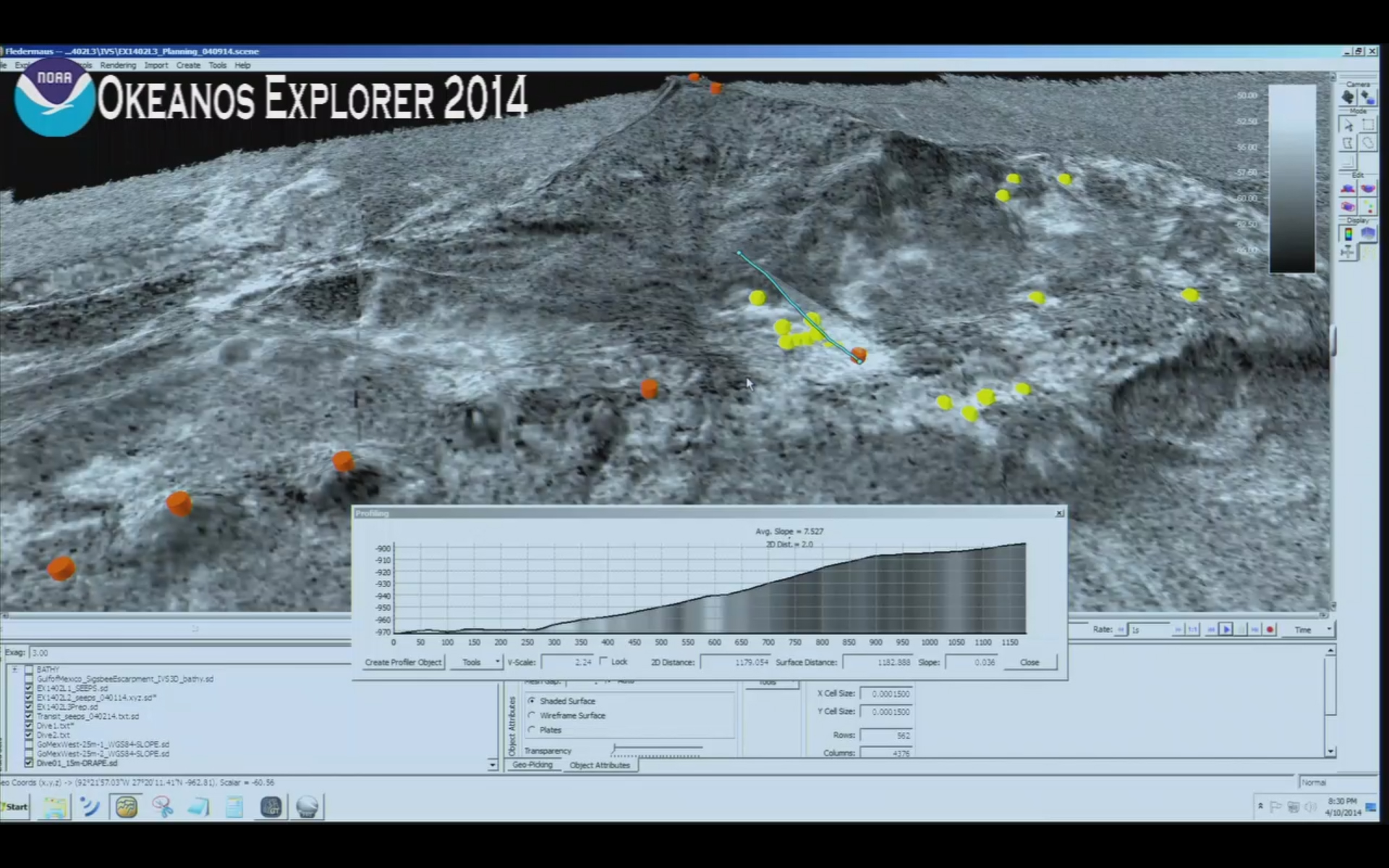
During remotely operated vehicle expeditions, the science team uses Fledermaus, a 3D visualization software, to view sonar data to help plan the upcoming dives. Our onboard science team displays the latest datasets collected by the ship and streams the computer display to shore as a live video feed so the entire team, regardless of location, can view the same computer display and engage in dive planning discussions. The image above displays the seafloor backscatter data at site GB648, which tells us the relative hardness of different areas of the seafloor (lighter areas are harder and likely carbonate material, and darker areas are softer and likely soft sediment). Orange dots are proposed dive waypoints, and the yellow dots are seafloor locations where our sonar detected possible gas bubble plumes emanating from the seafloor into the water column. Ultimately, the blue line in this image was decided upon by the group as the final dive target. Image courtesy of NOAA Okeanos Explorer Program, Gulf of Mexico 2014 Expedition. Download larger version (jpg, 921 KB).