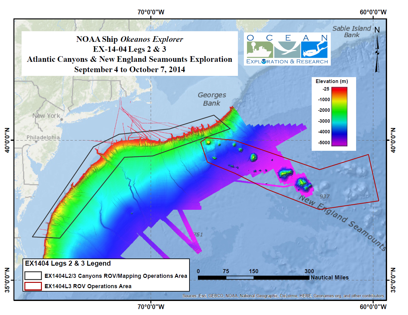
Color-coded bathymetry, previously collected by Okeanos Explorer and by the University of New Hampshire’s Center for Coastal and Ocean Mapping UNCLOS expeditions, processed with QPS Inc., Fledermaus software. Map created with ESRI ArcMap software.Download larger version (jpg, 829 KB).
Map showing areas that will be explored during the second and third legs of the expedition.
