
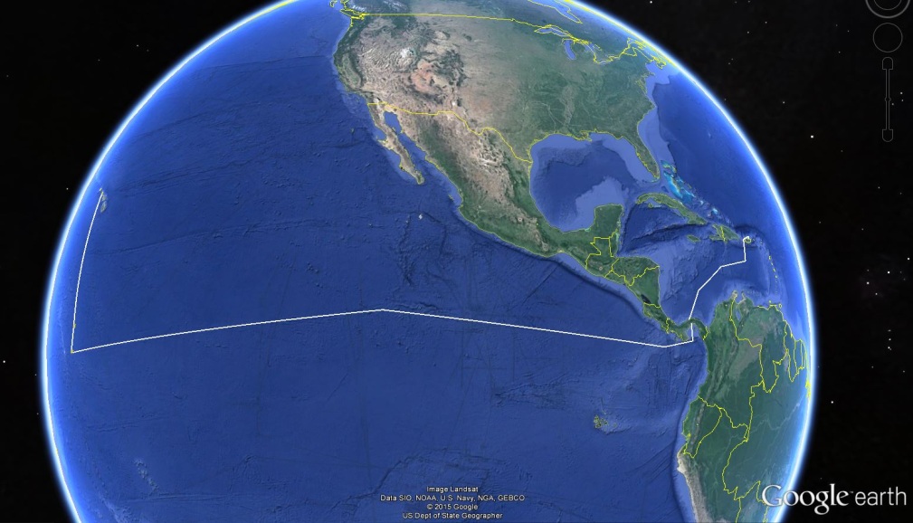
Proposed track lines for the ship during this expedition. Leg I is in the Caribbean Sea between San Juan, Puerto Rico, and Panama City, Panama. Leg II is in the eastern Pacific Ocean between Panama City, Panama, and Pearl Harbor, Hawaii, along the Clipperton Fracture Zone.