By Lindsay McKenna - Office of Ocean Exploration and Research
May 25, 2015

Figure 1: The new gravity anomaly map over the region we are transiting, with multibeam data collected by NOAA Ship Okeanos Explorer overlain in the bottom right image. Image courtesy of NOAA Office of Ocean Exploration and Research. Download larger version (jpg, 209 KB).
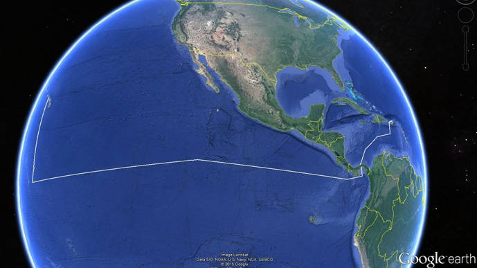
During this expedition, we are transiting over the East Pacific Rise. This region is marked by chains of seamounts and small undersea mountains called "knolls." Many of these volcanic underwater mountains have recently been identified through new seafloor maps derived by satellite altimetry. Satellite altimetry maps use gravity anomalies to identify features on the seafloor, and while they are great at identifying features on a large scale, they lack the high resolution that multibeam bathymetry mapping provides.

This feature is likely a knoll, which is an underwater mountain, usually of volcanic origin, that rises between 300 and 1,000 meters above the surrounding seafloor. Image courtesy of NOAA Office of Ocean Exploration and Research, Tropical Exploration 2015. Download larger version (jpg, 48 KB). View video of Knoll Map Fly-Through.
The top map in Figure 1 shows the new gravity anomaly map over the region we are transiting1. You can see numerous seafloor features at this scale. However when you zoom in, bottom left, it’s difficult to distinguish any fine-resolution characteristics. The bottom right image shows an overlay of multibeam bathymetry collected by NOAA Ship Okeanos Explorer during this expedition. This feature is over 3,000 meters deep and is mapped to a resolution of 65 meters. The next few images in this log show an example the kind of detail we can see when we map with swath sonars.
This feature is likely a knoll, which is an underwater mountain, usually of volcanic origin, that rises between 300 and 1,000 meters above the surrounding seafloor. This knoll rises 500 meters above the surrounding seafloor and has sloped sides as steep as 38°. The small sunken feature in the top of the mound could be a caldera.

This knoll is located on the flank of a larger seamount in the eastern Pacific Ocean about 200 miles off the Costa Rican coast in 2,500 meters of water. Image courtesy of NOAA Office of Ocean Exploration and Research, Tropical Exploration 2015. Download larger version (jpg, 107 KB).
This knoll is located on the flank of a larger seamount in the eastern Pacific Ocean about 200 miles off the Costa Rican coast in 2,500 meters of water. The feature seems to have a collapsed caldera, with a noticeable debris field located downslope of the mound. The images above are viewed in QPS, Inc. software Fledermaus at three times the vertical exaggeration.
There is inherent value in both satellite bathymetry and ship-based sonar bathymetry. Both tools are used by scientists to study our planet. Swath sonar bathymetry allows us to map to fine-scale features, like the collapsed caldera discovered on this expedition. However, it would take NOAA Ship Okeanos Explorer hundreds of years to map the area of seafloor that satellites can map in a matter of months or years.
1 - Sandwell, D. T., R. D. Müller, W. H. F. Smith, E. Garcia, R. Francis, New global marine gravity model from CryoSat-2 and Jason-1 reveals buried tectonic structure , Science, Vol. 346, no. 6205, pp. 65-67, doi:10.1126/science.1258213 , 2014.