
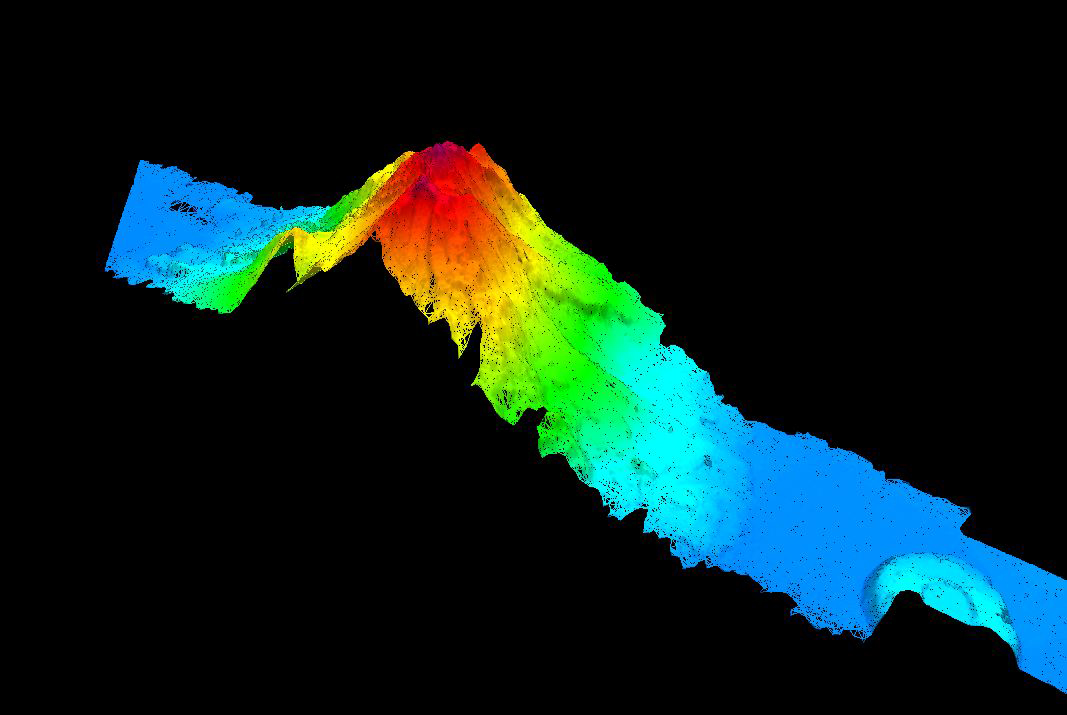
An unnamed seamount was mapped during our transit mapping operations today. The 2,865-meter high seamount's peak is 562 meters below the surface of the water, with surrounding water depths of 4,709 meters. Image courtesy of the NOAA Office of Ocean Exploration and Research, 1011 Hohonu Moana. Download larger version (jpg. 299 KB).