Dive 13 was conducted today on a ridge that extends to the southeast of an unnamed seamount east of Pearl and Hermes Atoll, to explore for high-density communities of deep-sea corals and sponges. The dive started at 2,305 meters close to the edge of the ridge on a substrate of heavily manganese-crusted and broken pillow lava that was covered with mostly planar bamboo corals (genus Keratoisis sp) and a few Chrysogorgia sp, and mushroom corals (Anthomastus sp). As the ROV moved up along the crest of the ridge, it became evident that the bamboo corals were all densely aggregated on the narrow ridge crest, oriented perpendicular to the current which was moving across the ridge. As the ROV continued moving upwards along the crest of the ridge, it passed through a couple of patches where the substrate consisted of cobble and did not contain any animals. The ROV left the bottom at a depth of 2,118 meters after covering a linear distance of 700 meters.
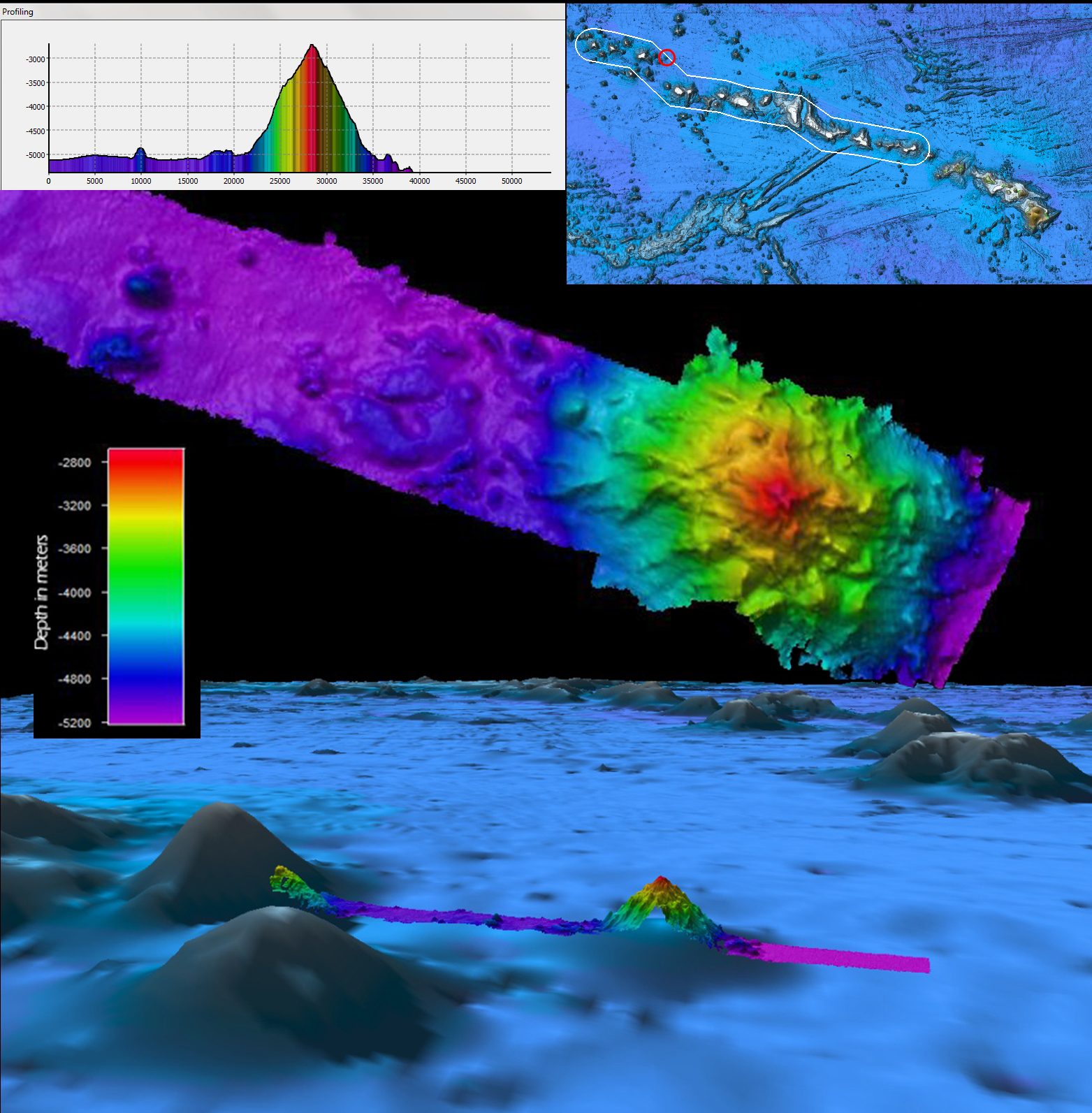
After the ROV dive, exploration mapping operations were conducted as usual during transit to the next ROV dive site. Along the way, an uncharted seamount rising approximately 2,818 meters or 8,800 feet (More than one and a third times taller than Mount Washington!) from the seafloor was mapped within the Monument boundary. The feature is 14.8 kilometers wide across the northwest-southeast axis, pyramidal or conical in shape with a sharply defined peak and no long ridge features present. The seamount previously appeared in satellite-derived bathymetry, but was inaccurately represented in terms of height.
Video highlights from Dive 13
