
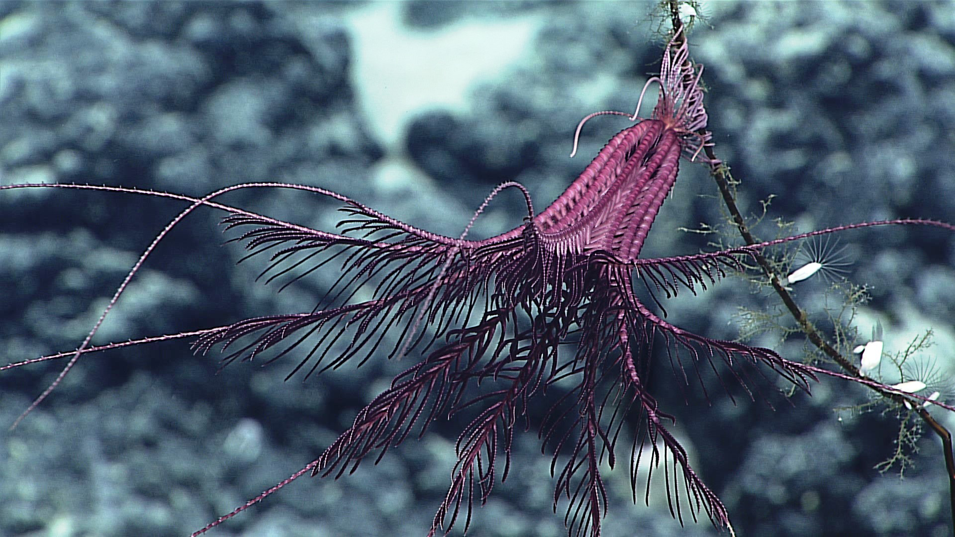
A purple crinoid hangs out on a dead coral stalk. Image courtesy of the NOAA Office of Ocean Exploration and Research, 2016 Hohonu Moana. Download larger version (jpg, 1.1 MB).
A purple crinoid hangs out on a dead coral stalk. Image courtesy of the NOAA Office of Ocean Exploration and Research, 2016 Hohonu Moana. Download larger version (jpg, 1.1 MB).
Seamounts
Dive 5 was conducted on March 5 on an unnamed seamount east of Bank 9 at a depth of 1,600 to 1,800 meters. This seamount had never been surveyed. Video courtesy of the NOAA Office of Ocean Exploration and Research, 2016 Hohonu Moana. Download larger version (mp4, 83.2 MB).
Dive 5 was located on a ridge extending to the southwest of an unnamed seamount located east of Bank 9. The unnamed seamount had never been previously surveyed, and therefore its geological age is unknown. The objectives of this dive were to (1) collect rock samples that could be used to determine the geological age of the seamount and (2) survey for high-density communities of corals and sponges along the ridge and summit of the seamount. The plan was for the remotely operated vehicle (ROV) to move up the ridge until reaching the highest point of the seamount at ~1,600 meters. Then the ROV would survey towards the northwest along a flat plateau located at the top of the seamount until running out of bottom time. The ROV landed on the ridge crest at a depth of 1,754 meters. The substrate consisted of heavy botryoidal Mn-crusted volcanic rubble with channelized sediment and ripples. The density of animals was moderate and consisted mainly of sponges and black, bamboo, and gorgonian corals. At 1,759 meters, the ROV collected a small, Mn-crusted rock sample. The source lava flow of this geological sample is unknown. Further up the slope,at 1,703 meters, the ROV collected a Stichopathes wire coral, which was the most abundant coral throughout the dive. Throughout the ascent along the ridge, the substrate was composed of Mn-encrusted volcanic talus and rubble with interspersed, fully cemented Mn-crusted hardpan and larger rock features. Sedimentation was generally light, with some ripple structures present in the channelized sediments. Near the top of the ridge and before gaining the summit area, the substrate changed to a fragmented and laminated sheet flow that draped the ridgeline. Within separated portions of the sheet flow, loose volcanics were present. The second geological sample was taken from a separation between two sheet flow blocks. This sample appears to be a portion from the laminations present in the sheet flow. At the top of the seamount, several types of corals were present that had not been observed previously on the dive. Towards the end of the dive, the ROV collected a Bathypathes black coral, which had a commensal squat lobster on it; however, the commensal squat lobster swam out of the collection box before it could be secured. The density of animals was moderate to throughout the dive, with isolated patches of high density. After the ROV was recovered, we commenced mapping operations. The weather over the next couple days does not look good, so we are monitoring the forecasts very closely.