-

D2 investigates a coral on an unnamed seamount west of Salmon Bank. Image courtesy of the NOAA Office of Ocean Exploration and Research, 2016 Hohonu Moana. Download larger version (jpg, 808 KB).
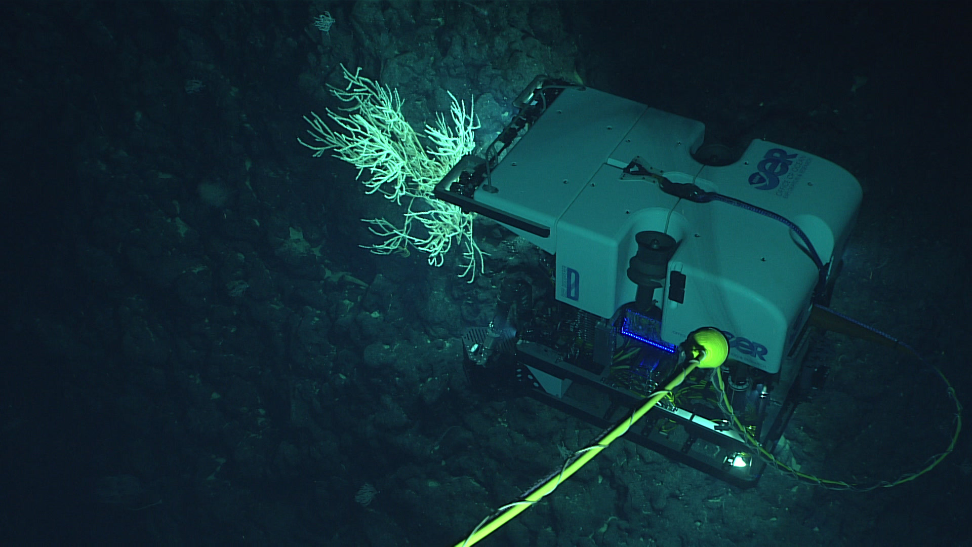
D2 investigates a coral on an unnamed seamount west of Salmon Bank. Image courtesy of the NOAA Office of Ocean Exploration and Research, 2016 Hohonu Moana. Download larger version (jpg, 808 KB).
Dive 6: Shrimp
Shrimp were just one of the many types of animals encountered during the March 9 dive on a previously unexplored seamount. Video courtesy of the NOAA Office of Ocean Exploration and Research, 2016 Hohonu Moana. Download larger version (mp4, 12.6 MB).
Dive 6 was conducted on the top portion of an unnamed seamount west of Salmon Bank. The seamount was mapped for the first time during this expedition and had never been previously surveyed. Therefore, its geological age and fauna were completely unknown. The target start point of the dive was on the crest of a ridge that extends to the south of the seamount at a depth of 1,261 meters. The remotely operated vehicle (ROV) landed on a steep slope next to the ridge at 1,290 meters. The bottom consisted of Mn-encrusted surface with scattered cobbles and rock ledges. Few animals were observed close to the landing site and included an eel, a halosaurdid, sponges, and corals. At 1,291 meters, the ROV collected a geological sample, which was angular, dense, and lightly crusted with manganese. As the ROV began its traverse up the ridgeline, the source outcrop for this loose sample was observed as a highly angular Mn-encrusted volcanic ledge. The density of animals increased significantly along the ridge and consisted mainly of primnoid corals, with some chrysogorgid corals in between. The density of animals was consistently moderate, with some portions of high density. The ROV left the bottom at 649 meters. Over the course of the dive, the ROV covered a large depth range (~650 meters) and transversed the oxygen minimum layer. The density of animals did not decrease in this layer, but rather changed from one dominated by primnoid corals to one dominated by chrysogorgid corals and tall Saccocalyx sponges. After the ROV was on deck, we starting mapping as we transited to Castellano Seamount in preparation for Thursday’s dive.