By Heidi Hirsh, Natural Resources Management Specialist - NOAA Fisheries Service, Marine National Monuments Program

Figure 1: Management designations within the Marianas Trench Marine National Monument. The green points denote islands. Image courtesy of the Marianas Trench Marine National Monument. Download image (jpg, 162 KB).
From April to July 2016, NOAA Ship Okeanos Explorer will conduct three telepresence-enabled ocean exploration and mapping cruises to obtain baseline information in and around the Marianas Trench Marine National Monument. This expedition is the second year of the three-year Campaign to Address Pacific monument Science, Technology, and Ocean NEeds (CAPSTONE). The NOAA Office of Ocean Exploration and Research conducted Submarine Ring of Fire expeditions in 2002, 2003, 2004, 2006, 2007, and 2014 in and around the Mariana Trench before it was designated as a Marine National Monument.
The Marianas Trench Marine National Monument (referred to here as “The Monument”) was established in January 2009 through a presidential proclamation under the authority of the Antiquities Act of 1906. The Monument was established for the purpose of protecting objects of interest such as the subduction system in the trench, submerged volcanoes, hydrothermal vents, coral reef ecosystems, and biologically diverse ecosystems where chemosynthetic and photosynthetic organisms exist side by side.
The Monument consists of three units: the Islands Unit, the Volcanic Unit, and the Trench Unit. The Volcanic Unit and the Trench Unit are additionally designated as National Wildlife Refuges, the “Mariana Trench National Wildlife Refuge” (aka “Trench Unit/Refuge”) and “Mariana Arc of Fire National Wildlife Refuge” (aka “Volcanic Unit/Arc of Fire Refuge”).
The Islands Unit encompasses the waters and submerged lands of the three northernmost Mariana Islands (Farallon de Pajaros, Maug, and Asuncion) from the mean low water line to approximately 50 nautical miles offshore. These waters include healthy coral reefs made up of roughly 300 different coral species and a very high density of top predators, including large numbers of sharks.

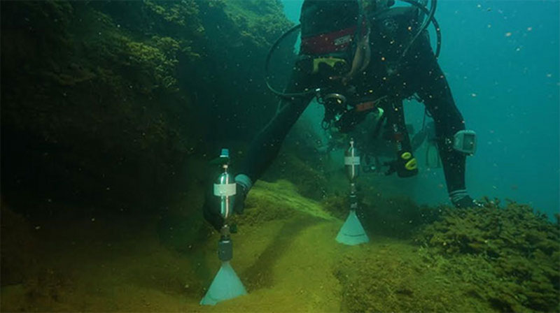
NOAA divers collecting gas bubble samples using evacuated stainless steel sample cylinders with plastic funnels attached as part of ocean acidification research at Maug. Image courtesy of NOAA/Open Boat Films. Download image (jpg, 51 KB).
The Volcanic Unit/Arc of Fire Refuge includes the submerged lands within a one nautical mile radius of the center of each of the 18 active submarine volcanoes and hydrothermal vents in the region. Species survive here in the midst of hydrothermal vents that produce highly acidic and boiling hot water, some of the harshest conditions on the planet. Vent communities include squat lobsters, as well as tubeworms, clams, and mussels that have developed a symbiotic relationship with chemosynthetic bacteria.

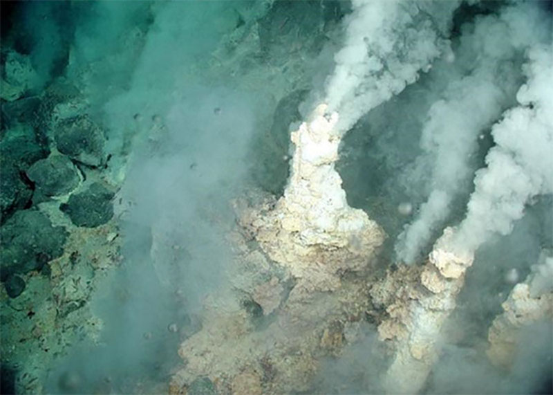
Liquid carbon dioxide bubbles being released from fractures adjacent to white-smoker sulfur chimneys at the Champagne vent, NW Eifuku volcano. Image courtesy of the NOAA Vents Program. Download image (jpg, 75 KB).
The Champagne vent, located at the NW Eifuku undersea volcano, produces almost pure liquid carbon dioxide. This phenomenon has only been observed at one other site in the world, in the Okinawa Trough.
The Trench Unit/Refuge encompasses the submerged lands within the Mariana Trench extending from the northern limit of the U.S. Exclusive Economic Zone (EEZ) of the Commonwealth of the Northern Mariana Islands (CNMI), to the southern limit of the EEZ adjacent to the U.S. Territory of Guam.
This part of the Monument is approximately 940 nautical miles long and 38 nautical miles wide along the Mariana Trench seafloor. It includes Sirena Deep at about 35,000 feet, the second deepest point on Earth, remarkable for its steep walls, distinctive geologic features, and deep-ocean life forms. Xenophyophores that resemble giant amoebae, deep-sea jellyfish, shrimplike amphipods, and translucent sea cucumbers have found a home in this harsh environment amid shaggy bacterial mats.
The ocean floor at such depth consists of a biogenous ooze composed of microscopic plankton shells from both animal and plant plankton. The deepest areas of the Mariana Trench are likened to an inverted chain of islands, where each “peak” points downward, but like islands, each feature can be geologically and biologically unique. Scientists on the Schmidt Ocean Institute R/V Falkor expedition to the Mariana Trench , November-December 2014, discovered 18 new species below 21,000 feet.

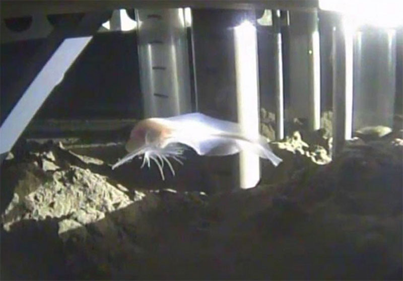
New “ghost fish” species, yet to be officially classified and named. Image collected from the Falkor in the Mariana Trench. Image courtesy of the Schmidt Ocean Institute. Download image (jpg, 54 KB).
The unique geology, geochemistry, rare biological conditions, and pristine ecosystems of the Monument provide an ideal location for interdisciplinary research. Because the area has a distinct position in the biogeography of the Pacific as a place where a high number of regional endemic and unusual species assemblages thrive, the Mariana Archipelago and Monument holds outstanding potential for making globally significant scientific contributions.
CAPSTONE mapping efforts may reveal new seamounts and geologic features, providing insight to the ocean floor features, plate tectonic activity, and new discoveries into the continued creation of the continents and connectivity to all life on Earth.
The scientific research to be conducted on the upcoming Okeanos Explorer expedition to the Mariana region is expected to assist sustainable fisheries management and deep-sea education initiatives; improve our understanding of the unique biology, geology, and deepwater habitats of the region; and offer the opportunity to engage new partnerships, exchange knowledge, and develop innovative tools for humanity to live sustainably on Earth.