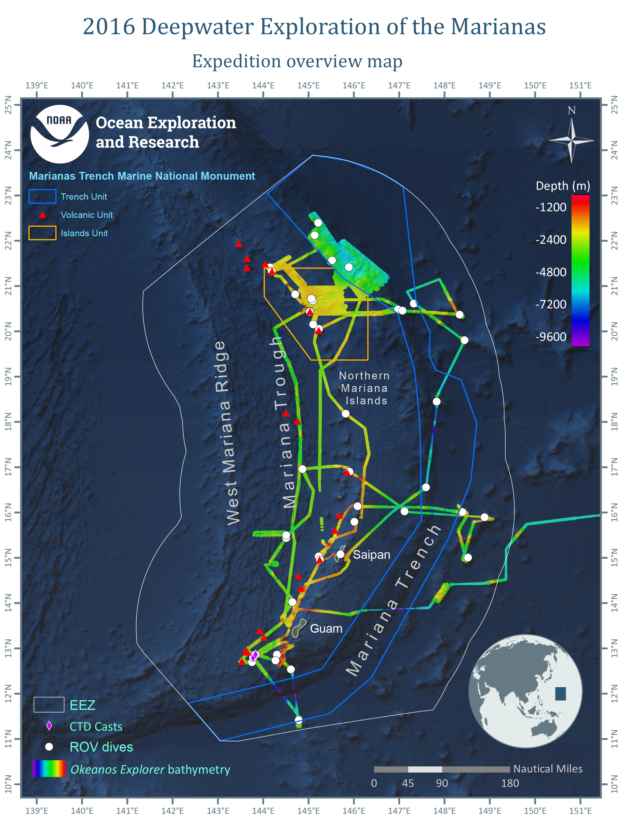
Overview map showing seafloor bathymetry, remotely operated vehicle dives, and CTD casts conducted during the expedition.
