
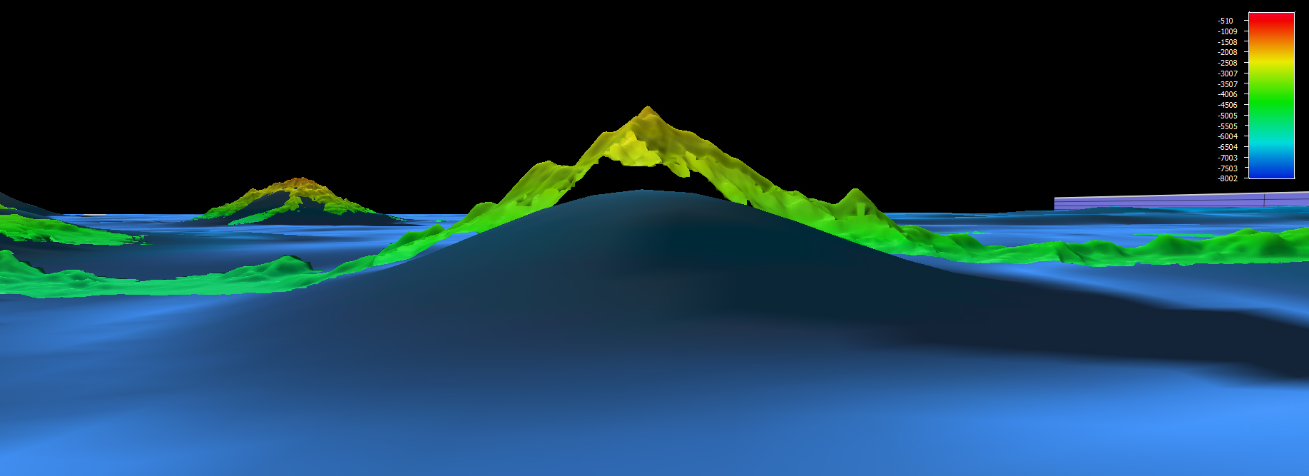
From January 20 to February 11, 2017, NOAA Ship Okeanos Explorer conducted a mapping reconnaissance expedition in PRIMNM. In the Jarvis Unit of PRIMNM, multibeam data revealed an approximate 1,700 meter seamount height difference when compared to previous satellite altimetry. This is a great example of why it is important to map the seafloor using modern, high-resolution sonar systems.