A previously unmapped seamount we are calling “Kahalewai”. This seamount has four ridges that radiate outward from the center.

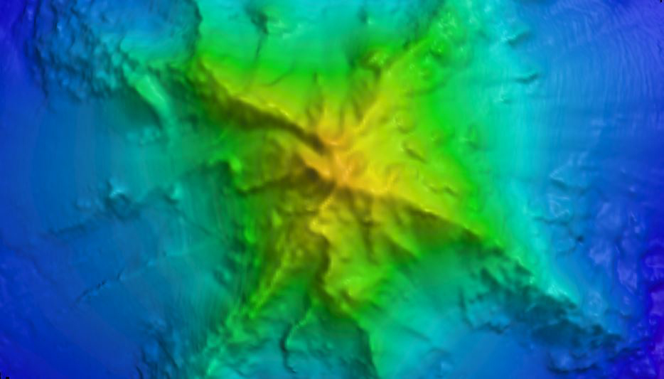
A previously unmapped seamount we are calling "Kahalewai." This seamount has four ridges that radiate outward from the center. Image courtesy of the NOAA Office of Ocean Exploration and Research, Mountains in the Deep: Exploring the Central Pacific Basin. Download larger version (jpg, 245 KB).

This ~4,200 meter (~13,800 foot) 
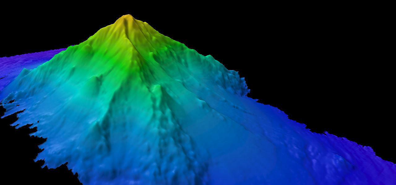
high seamount we are calling “Kahalewai” was almost ~1000 meters taller than previously thought.

This ~4,200-meter (~13,800-foot) high seamount we are calling "Kahalewai" was almost 1,000 meters taller than previously thought. Image courtesy of the NOAA Office of Ocean Exploration and Research, Mountains in the Deep: Exploring the Central Pacific Basin. Download larger version (jpg, 251 KB).

Mapping All the Way
May 3, 2017

NOAA Ship Okeanos Explorer began mapping operations overnight and continued throughout the day while in transit. This area contains a long stretch of flat abyssal seafloor, which is one of the largest habitats in the world, and we found no major seamounts on our track until we got close to our dive site. Rising from the muddy abyss, an approximately ~4,200-meter (~13,800-foot) seamount was mapped - that is about 11 times the height of the Empire State Building. The unnamed seamount that we are calling "Kahalewai (to read about Carl Kahalewai, click here) has four ridges that radiate outward from the center. This seamount turned out to rise about 1,000 meters (~3,000 feet) higher from the abyssal plain than expected, based on altimetry data. This discovery is another reminder about the importance of high-resolution bathymetric mapping. We have higher-resolution maps of the surface of Mars than we do of the underwater surface of our own planet. Data like these fill in large gaps in our knowledge and give us a better understanding of the world we live in.