
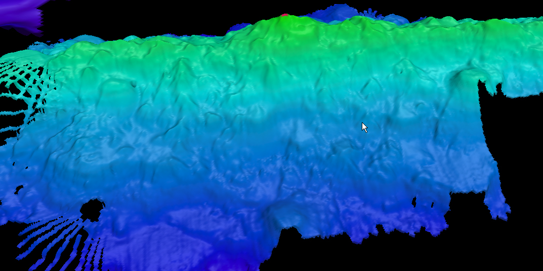
Altimetry data informed us that this ridge feature existed and we selected it as a target for high-resolution bathymetric mapping. Much to our surprise, the ridge turned out to be over a full kilometer higher than previously thought. This is one of the many reasons that high-resolution bathymetry mapping is so important — it allows us to better understand our planet.