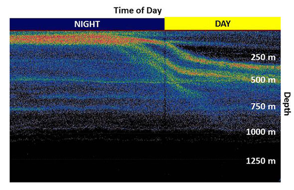

An echogram, showing acoustic backscatter. The horizontal axis is time, with the most recent recording on the righthand side of the plot. Note the layer of highest backscatter (reds and yellows) moved from the surface to over 300 m depth in the morning.