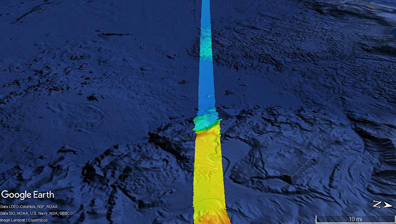
With approximately 95 percent of the ocean unexplored, the NOAA Office of Ocean Exploration and Research pursues every opportunity to map, sample, explore, and survey at planned destinations as well as during transits; Always Exploring is a guiding principle. Mapping data is collected at all times when the ship is transiting and underway. This image shows the multibeam bathymetry data acquired during the ship's transit west from Oahu to the Johnston Atoll Unit.

With approximately 95 percent of the ocean unexplored, the NOAA Office of Ocean Exploration and Research pursues every opportunity to map, sample, explore, and survey at planned destinations as well as during transits; "Always Exploring" is a guiding principle. Mapping data is collected at all times when the ship is transiting and underway. This image shows the multibeam bathymetry data acquired during the ship's transit west from Oahu to the Johnston Atoll Unit. Image courtesy of the NOAA Office of Ocean Exploration and Research, 2017 Laulima O Ka Moana. Download larger version (jpg, 332 KB).

Day 5: Transit to the Johnston Atoll Unit
July 11, 2017

Underway mapping was conducted today as the ship continued transiting to the Johnston Atoll Unit of the Pacific Remote Islands Marine National Monument for the first dive of the expedition. The transit to the first dive site is about 600 nautical miles and is expected to take about 2.5 days, depending on transit speed. The onboard team used the transit day to work on various tasks, including training new personnel, writing standard operating procedures (SOPs), cleaning and maintaining equipment, troubleshooting minor issues, and preparing for the next dive.