Map of the general expedition operating area. The white polygon denotes the Gulf of Mexico 2017/2018 expeditions operating area for the Okeanos Explorer. The color-coded bathymetry shows cumulative multibeam sonar bathymetry collected previously by the Okeanos Explorer.
Expedition Map
Image courtesy of the NOAA Office of Ocean Exploration and Research.
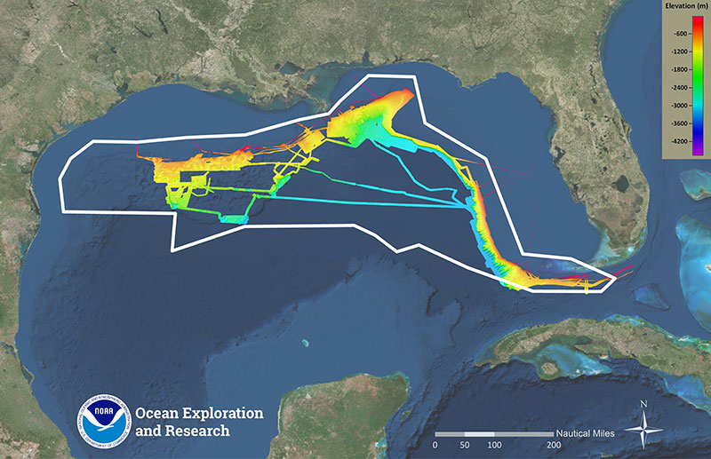
Map of the general expedition operating area. The white polygon denotes the Gulf of Mexico 2017/2018 expeditions operating area for the Okeanos Explorer. The color-coded bathymetry shows cumulative multibeam sonar bathymetry collected previously by the Okeanos Explorer. Download larger version (jpg, 13.4 MB).
Learn more