Perdido Canyon was identified as a high priority for this expedition, as this remote area had never been surveyed with deep-sea submersibles by the scientific community. Interestingly, the dive site was located less than two nautical miles away from one of the largest and deepest oil rigs in the world! There were no high-resolution maps of the canyon, so we arrived on site early to collect mapping data. The purpose of Dive 05 was to survey the biology and geology of the north wall of Perdido Canyon in order to provide important baseline information about an unexplored deep-sea canyon. Submarine canyons are generally regarded as hotspots of abundance and biodiversity and are poorly surveyed in many remote locations like the western Gulf of Mexico.
Remotely operated vehicle (ROV) Deep Discoverer (D2) reached the seafloor at 2,786 meters (~9,140 feet) depth on a heavily sedimented, flat area with a sea pen (Umbellua sp.) near the landing spot. Beginning on the floor of Perdido Canyon, D2 then headed northwest up a sediment-covered mound oriented across the canyon axis, before moving north up the canyon wall. Fine-grained sediment cover characterized the lower portions of the canyon wall, which was interspersed with periodic excavation burrows. Linear ripples, with ripple crests oriented north-south, indicated that the prevailing currents move parallel to the canyon axis, the same direction the ROV pilots noticed currents during the dive. Higher portions of the canyon wall had limited fractured rock rubble and some outcrops of layered sedimentary rock. D2 briefly explored the top of the canyon wall, at a depth of 2,600 meters (~8,530 feet), and the canyon rim to the northwest.
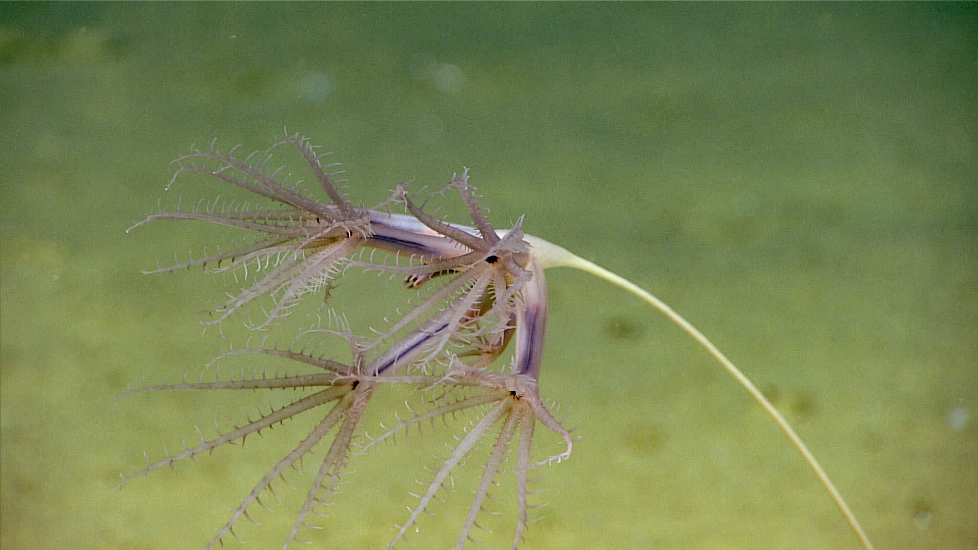
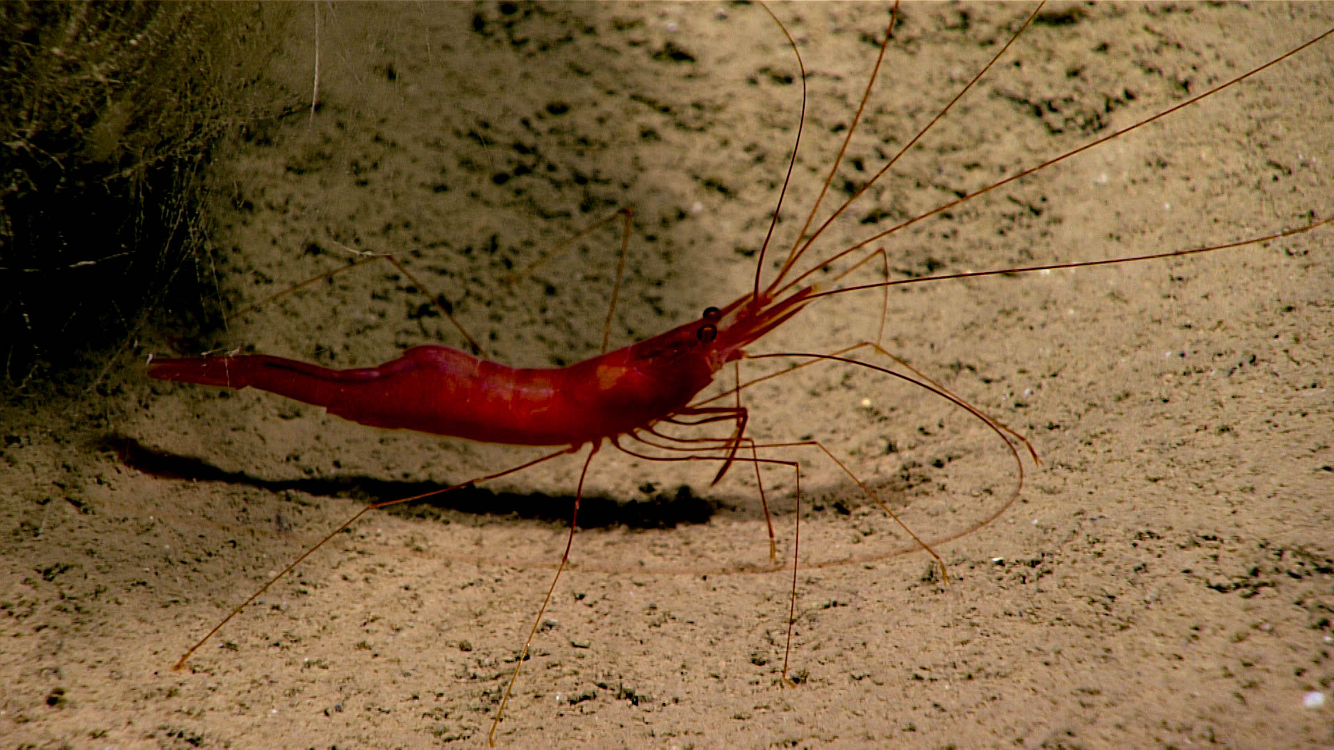
The most commonly observed animals included sea pens (Umbellula sp.), holothurians (Benthodytes typica), glass sponges (Hyalonema sp.), shrimp (Nematocarcinus ensifer), a Hormetheiid anemone, an unidentified anemone, tubeworms, and tripod fishes (Bathypterois phenax and B. grallator). Star-shaped impressions on the sediment were commonly observed throughout the dive, some with a mudstar (Dytaster sp.) partially burrowed. Several species of fishes were observed, including grenadiers (Coryphaenoides mediterraneus), cusk eel (Bassogigas? sp.), and a fish with the best common name ever: bony-eared assfish (Acanthonus armatus). Other species observed during the dive included unidentified glass sponges, a brittle star (Ophiomusa lymeni), sea pens (Anthopthilum sp.), bryozoans, a holothurian (Benthothuria sp.), a tube-dwelling anemone (Ceriantharia), and a crab (Parapagurus sp.) with commensal cup corals.
D2 came off bottom to address a problem with the configuration of its tether with Serios. After the problem was addressed, there was insufficient time to return to the seafloor. This concluded the dive approximately 25 minutes early.

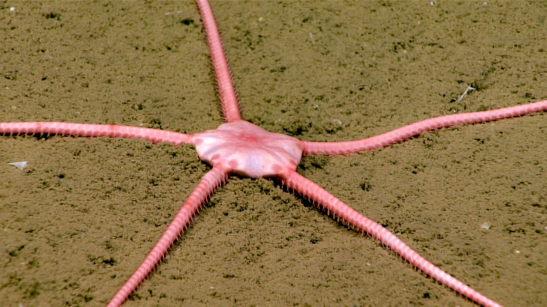
 brittle star (Ophiomusa lymeni) is very common on soft sediments in the Gulf of Mexico.")
 was found at a depth of ~2,770 meters (~9,090 feet).")