by Kasey Cantwell, Expedition Coordinator, NOAA Office of Ocean Exploration and Research
Cheryl Morrison, Co-science Lead, U.S. Geological Survey
Leslie Sautter, Co-science Lead, College of Charleston
, will be used to image unexplored areas of the Blake Plateau, Blake Ridge, Blake Escarpment, submarine canyons offshore of North Carolina, submerged cultural heritage sites, areas predicted to be suitable habitat for deep sea corals and sponges, inter-canyon areas, and gas seeps. Image courtesy of NOAA Office of Ocean Exploration and Research.")
The remotely operated vehicle Deep Discoverer (D2) will be used to image unexplored areas of the Blake Plateau, Blake Ridge, Blake Escarpment, submarine canyons offshore of North Carolina, submerged cultural heritage sites, areas predicted to be suitable habitat for deep-sea corals and sponges, inter-canyon areas, and gas seeps. Image courtesy of the NOAA Office of Ocean Exploration and Research. Download image (jpg, 528 KB).
From May 22 through July 2, 2018, NOAA and partners will conduct a two-part, telepresence-enabled ocean exploration expedition on NOAA Ship Okeanos Explorer to collect critical baseline information about unknown and poorly understood deepwater areas of the Southeastern United States. During the Windows to the Deep 2018: Exploration of the Southeast U.S. Continental Margin expedition, our at-sea and shore-based science teams will work together to map the seafloor and observe many of these sites for the first time.
The first leg of this expedition, which took place from May 22 to June 6, involved the collection of seafloor and water column mapping data to further improve fundamental understanding in this region and to facilitate remotely operated vehicle (ROV) dive planning. ROV dives are planned from June 14 to July 1 during the expedition’s second leg, at depths ranging from 250 to 4,000 meters (820 to 13,124 feet).
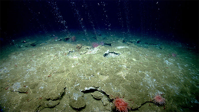
Mapping and ROV operations include, but are not limited to, unexplored areas of the Blake Plateau, Blake Ridge, Blake Escarpment, submarine canyons offshore of North Carolina, submerged cultural heritage sites, areas predicted to be suitable habitat for deep-sea corals and sponges, inter-canyon areas, and gas seeps. The ROV dives will enable scientists and managers to build a better understanding of the diversity and distribution of deepwater habitats in this region, to allow informed resource management decisions.
This is the first NOAA Ship Okeanos Explorer expedition that will contribute to NOAA’s Atlantic Seafloor Partnership for Integrated Research and Exploration (ASPIRE), a major multi-year, multi-national collaborative field program focused on raising collective knowledge and understanding of the North Atlantic Ocean.
, but much of the Blake Plateau remains unmapped and poorly explored. This expeditions will contribute much needed ROV surveying and bathymetry data to build upon this foundation.")
Over the past decade, NOAA Ship Okeanos Explorer and the U.S. Extended Continental Shelf Project have mapped much of the deepwater habitats offshore the U.S. east coast (assembled bathymetry shown above), but much of the Blake Plateau remains unmapped and poorly explored. This expeditions will contribute much needed ROV surveying and bathymetry data to build upon this foundation. Image courtesy of the NOAA Office of Ocean Exploration and Research. Download image (jpg, 379 KB).
The deepwater areas offshore Florida, Georgia, South Carolina, and North Carolina are some of the least explored areas along the U.S. East Coast. Though the East Coast is home to millions of Americans and is experiencing some of the highest population growth rates in the U.S., the southeast U.S. continental margin has some of the largest gaps in high-resolution ocean mapping data on the East Coast and limited previous observations via submersibles. Exploratory missions, such as those conducted via NOAA Ship Okeanos Explorer, are necessary to expand our knowledge of unknown and poorly known deepwater areas and to provide data for decision makers.
This expedition builds on the 2003 Windows to the Deep expedition which laid the groundwork for what we now know about environments along the edge of the southeastern U.S. continental margin. With the upcoming ROV dives and mapping, we hope to continue to enhance our understanding of this fascinating region.
The Windows to the Deep 2018: Exploration of the Southeast U.S. Continental Margin expedition will address science themes and priority areas put forward by scientists and managers from NOAA, management agencies in the region, and the ocean science community. NOAA priorities for the expedition include a combination of science, education, outreach, and open data objectives that will support management decisions at multiple levels:

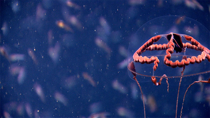
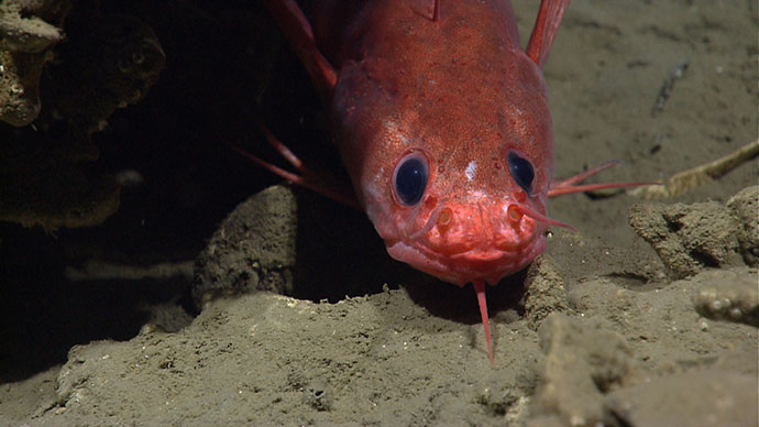
During this expedition, scientists and managers will be collecting data in areas predicted to be suitable habitat for deep-sea corals similar to this location imaged during the NOAA Ship Okeanos Explorer 2013 Northeast U.S. Canyons expedition. Image courtesy of the NOAA Office of Ocean Exploration and Research. Download image (jpg, 1.7 MB).
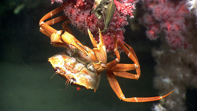
During the second leg of the expedition, we will conduct 24-hour operations consisting of daytime ROV dives and overnight mapping. The 20 planned ROV dive sites are expected to include deep-sea coral and sponge habitats, submarine canyons, cold seeps and chemosynthetic communities, and areas of cultural heritage that may be of potential marine archaeological significance.
Prior to the first leg of this expedition in May and June 2018, there was limited high-resolution multibeam mapping in the deepwater areas offshore the southeastern U.S. During the second leg, we will continue to expand bathymetry coverage, leaving behind a rich legacy of publicly available data that will likely reveal dozens of new insights into the deepwater habitats of this region.
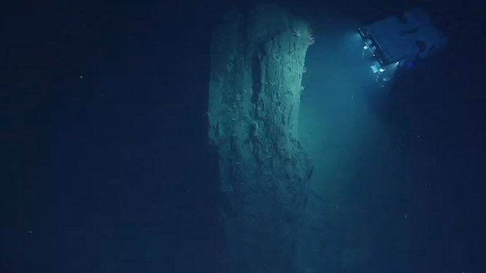
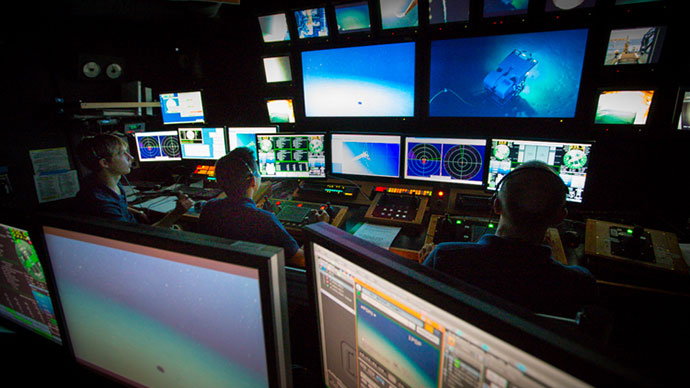
NOAA works with the scientific and resource management communities to characterize these areas through telepresence-based exploration. Operations use the ship’s deepwater mapping systems, NOAA’s dual-bodied 6,000-meter ROVs Deep Discoverer and Seirios, and a high-bandwidth satellite connection for real-time ship-to-shore communications. ROV dives will include high-resolution visual surveys and limited sampling. This expedition will help establish foundational information in the region to catalyze further exploration, research, and management activities.
Live video of dives can be viewed online in real time from June 14 through July 1, 2018.
Telepresence technology allows us to engage the majority of the science team from shore. NOAA uses telepresence technology to transmit data in real time to a shore-based team of scientists who actively participate in expeditions. Scientists participating from around the world contribute their expertise to operations in real time when discoveries are made at sea.
These shore-based scientists interact with the ship through a teleconference line and Internet collaboration tools. Using these communication tools, scientists and students help guide at-sea operations in real time, extending the reach of ocean exploration to more scientists and students than could possibly be accommodated onboard of any single vessel.
During the expedition, several scientists will also work together and stand watches at Exploration Command Centers (ECCs). When Okeanos Explorer expeditions first started, ECCs were the only way that scientists could engage with the ship in real time. As technology has advanced, scientists located anywhere with an Internet connection can participate in missions. However, many scientists still prefer to be co-located with their colleagues at an ECC, as is the closest atmosphere to being in the collaborative environment that naturally forms on a ship. Also, working from an ECC removes scientists from their busy lives and allows them to focus on the expedition.
The same technology that allows scientists around the world to participate in the expedition from land also enables interested members of the public to experience deep-sea exploration, the wonder of discovery, and the fascination of science in real time! The live video feeds are available to anyone online, providing the public with a front row seat to discoveries as they are made.
Web content developed for this expedition includes background essays; mission logs; daily updates; videos and images; and a live video feed. Education materials allow educators and students to engage their classrooms using products tied to the expedition, including standards-based lesson plans, background information, ocean career connections, links to previous Office of Ocean Exploration and Research-sponsored expeditions, and more.