-

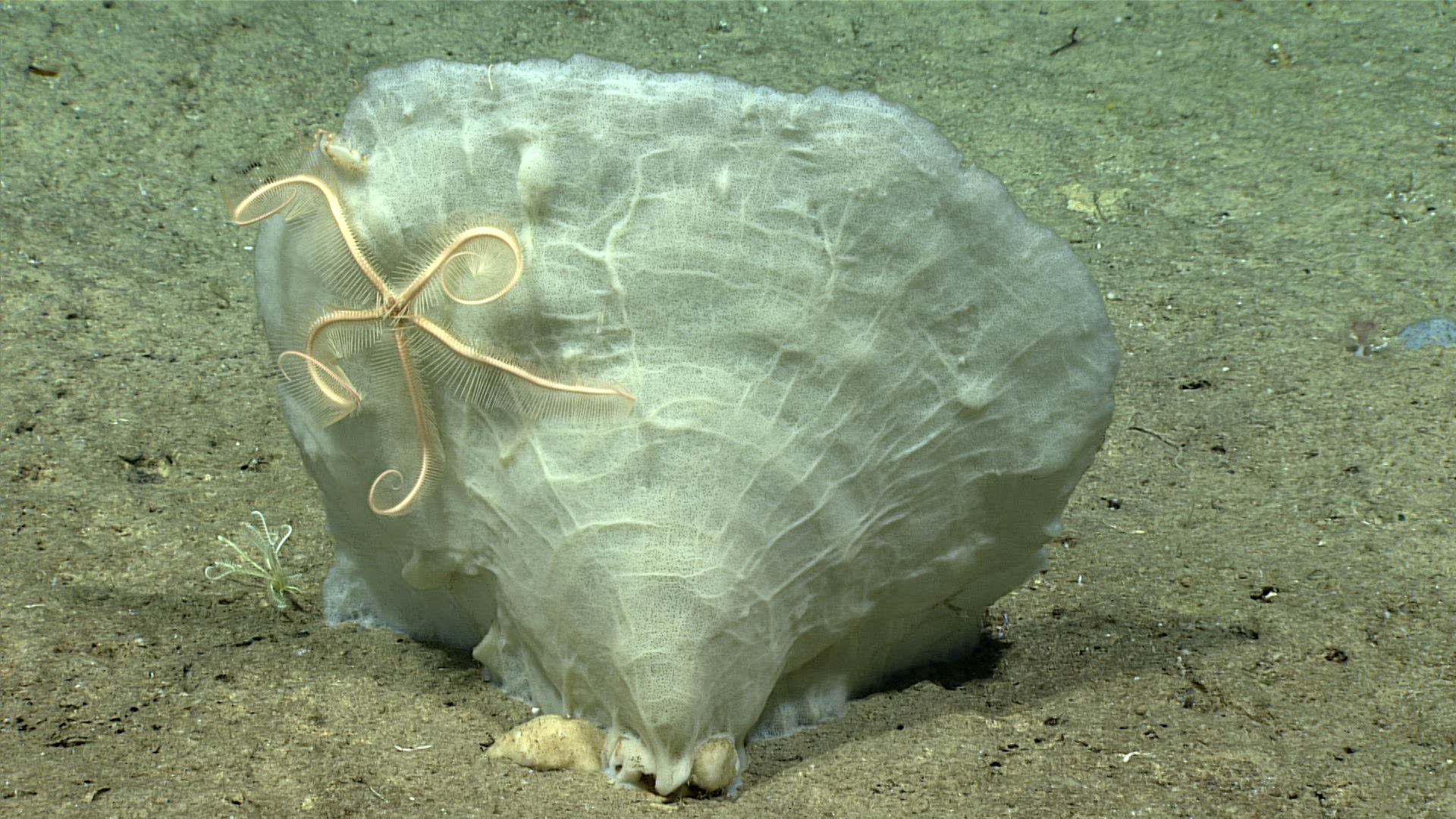
Phakellia sp. sponge with commensal brittle star seen during Dive 16. Image courtesy of the NOAA Office of Ocean Exploration and Research, Exploring Deep-sea Habitats off Puerto Rico and the U.S. Virgin Islands. Download larger version (jpg, 1.3 MB).
-

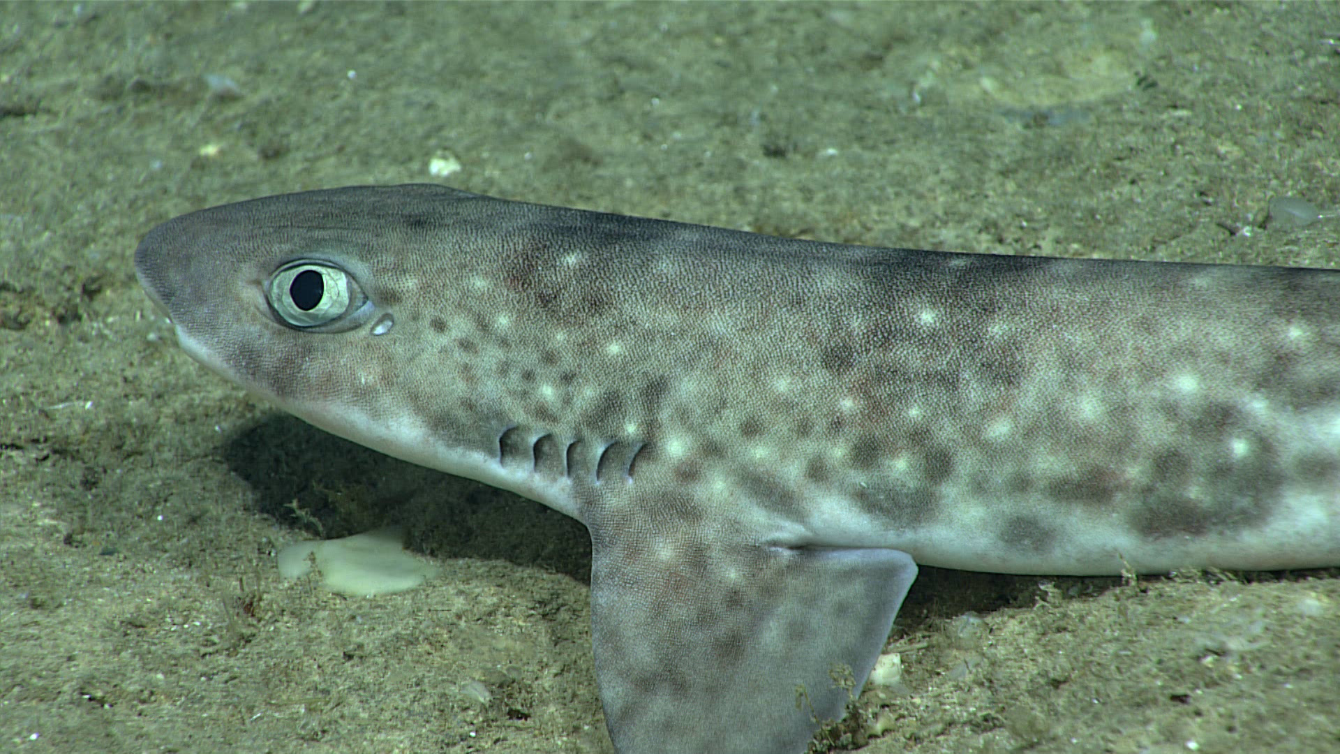
Catshark Scyliorhinus sp. seen resting on the seafloor during Dive 16. Image courtesy of the NOAA Office of Ocean Exploration and Research, Exploring Deep-sea Habitats off Puerto Rico and the U.S. Virgin Islands. Download larger version (jpg, 1.4 MB).
-
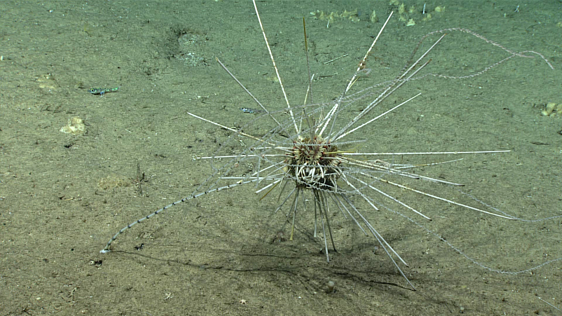
 feeding on a crinoid during this dive.")
Histocidaris nuttingi sea urchin eating a bamboo coral. Besides this predatory behavior, we also saw another species of sea urchin (Cidaris rugosa) feeding on a crinoid during this dive. Image courtesy of the NOAA Office of Ocean Exploration and Research, Exploring Deep-sea Habitats off Puerto Rico and the U.S. Virgin Islands. Download larger version (jpg, 1.4 MB).
-

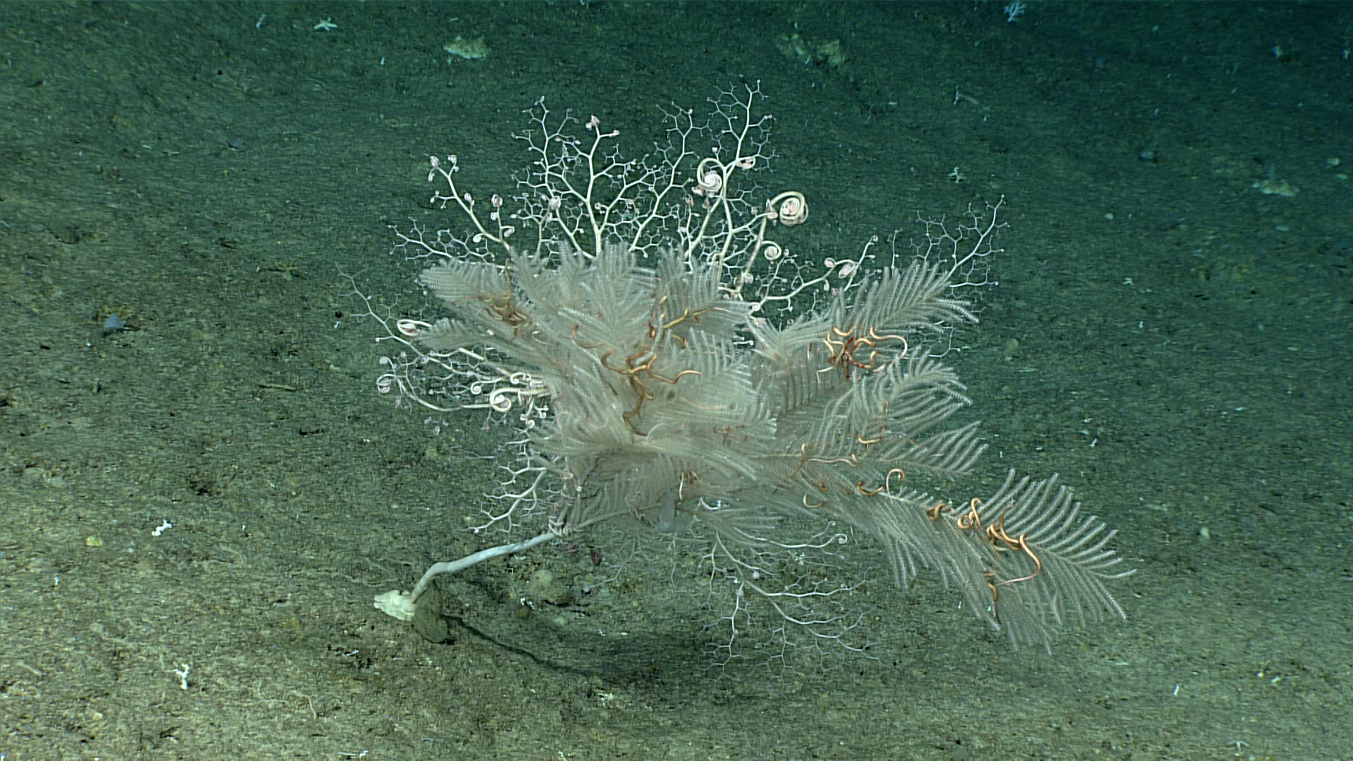
Callogorgia sp. sea fan with numerous commensal brittle stars and basket stars perched on its branches. Image courtesy of the NOAA Office of Ocean Exploration and Research, Exploring Deep-sea Habitats off Puerto Rico and the U.S. Virgin Islands. Download larger version (jpg, 1.4 MB).

