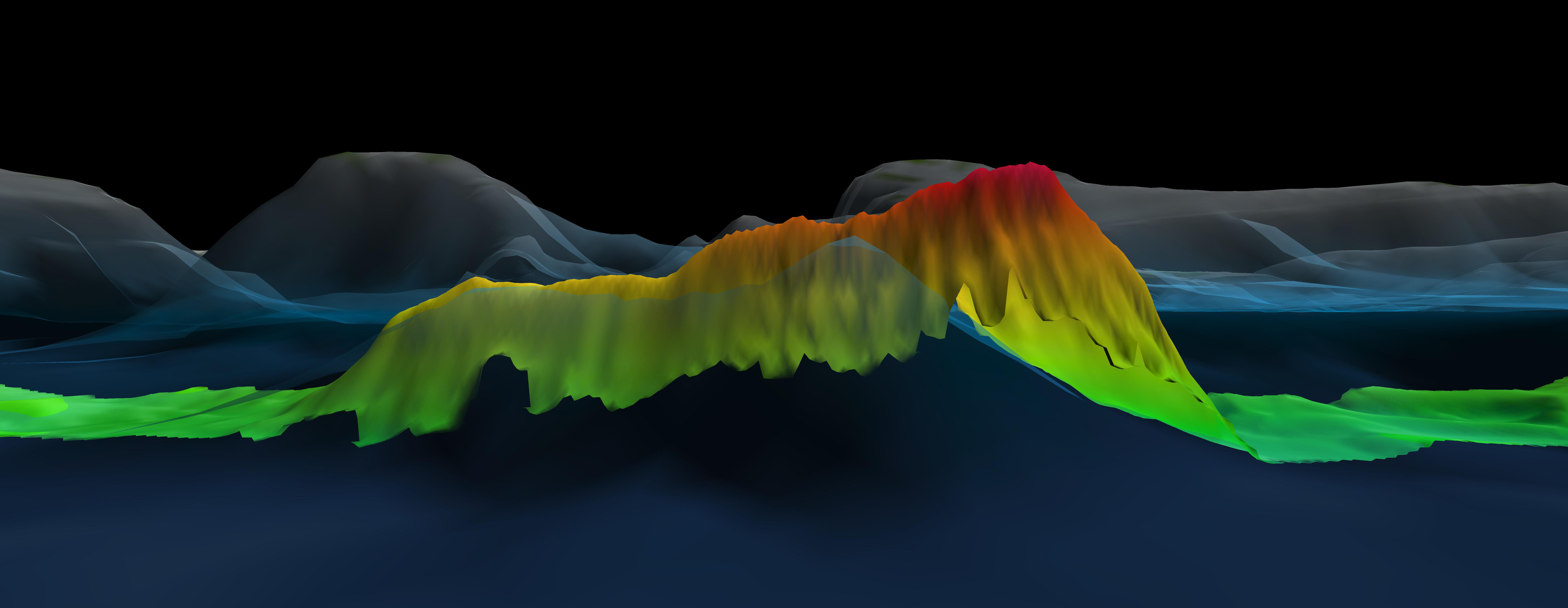
Seamount Mapped During Transit
This 2,600 meter (8,350 foot) seamount was mapped during a strategically planned transit from Puerto Rico to the Bahamas and discovered to be nearly 800 meters (2,625 feet) shallower than predicted by the satellite bathymetry. The bathymetry collected during the expedition (in rainbow) overlays the Global Multi-Resolution Topography grid.
 seamount was mapped during a strategically planned transit from Puerto Rico to the Bahamas and discovered to be nearly 800 meters (2,625 feet) shallower than predicted by the satellite bathymetry. The bathymetry collected during the expedition (in rainbow) overlays the Global Multi-Resolution Topography grid.")