NOAA Ship Okeanos Explorer maximized its time leeward of the Grand Bahama Island while taking refuge from unfavorable weather conditions. In total, 1,700 square kilometers (656 square miles) of this area were mapped, including this meandering canyon feature.
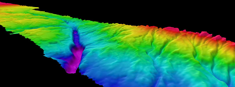
Canyon Feature near Grand Bahama Island
Image courtesy of the NOAA Office of Ocean Exploration and Research, Mapping Deepwater Areas in the Caribbean and South Atlantic Bight. Download larger version (jpg, 3 MB).
NOAA Ship Okeanos Explorer maximized its time leeward of the Grand Bahama Island while taking refuge from unfavorable weather conditions. In total, 1,700 square kilometers (656 square miles) of this area were mapped, including this meandering canyon feature.
Learn more